Ferrières | |
|---|---|
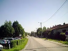 A view within Ferrières | |
 Coat of arms | |
Location of Ferrières | |
 Ferrières  Ferrières | |
| Coordinates: 48°33′19″N 6°17′40″E / 48.5553°N 6.2944°E | |
| Country | France |
| Region | Grand Est |
| Department | Meurthe-et-Moselle |
| Arrondissement | Nancy |
| Canton | Lunéville-2 |
| Intercommunality | Pays du Sel et du Vermois |
| Government | |
| • Mayor (2020–2026) | Bernard Leheux[1] |
| Area 1 | 6.25 km2 (2.41 sq mi) |
| Population | 327 |
| • Density | 52/km2 (140/sq mi) |
| Time zone | UTC+01:00 (CET) |
| • Summer (DST) | UTC+02:00 (CEST) |
| INSEE/Postal code | 54192 /54210 |
| Elevation | 254–361 m (833–1,184 ft) (avg. 300 m or 980 ft) |
| 1 French Land Register data, which excludes lakes, ponds, glaciers > 1 km2 (0.386 sq mi or 247 acres) and river estuaries. | |
Ferrières is a commune in the Meurthe-et-Moselle department in north-eastern France.
See also
References
- ↑ "Répertoire national des élus: les maires". data.gouv.fr, Plateforme ouverte des données publiques françaises (in French). 2 December 2020.
- ↑ "Populations légales 2021". The National Institute of Statistics and Economic Studies. 28 December 2023.
Wikimedia Commons has media related to Ferrières (Meurthe-et-Moselle).
This article is issued from Wikipedia. The text is licensed under Creative Commons - Attribution - Sharealike. Additional terms may apply for the media files.