Hirschbach | |
|---|---|
 Center of Hirschbach with the chapel | |
 Flag .svg.png.webp) Coat of arms | |
Location of Hirschbach within Amberg-Sulzbach district  | |
 Hirschbach 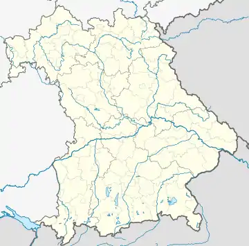 Hirschbach | |
| Coordinates: 49°33′N 11°32′E / 49.550°N 11.533°E | |
| Country | Germany |
| State | Bavaria |
| Admin. region | Oberpfalz |
| District | Amberg-Sulzbach |
| Municipal assoc. | Königstein (Bayern) |
| Government | |
| • Mayor (2020–26) | Hermann Mertel[1] |
| Area | |
| • Total | 26.76 km2 (10.33 sq mi) |
| Elevation | 390 m (1,280 ft) |
| Population (2022-12-31)[2] | |
| • Total | 1,182 |
| • Density | 44/km2 (110/sq mi) |
| Time zone | UTC+01:00 (CET) |
| • Summer (DST) | UTC+02:00 (CEST) |
| Postal codes | 92275 |
| Dialling codes | 09665 |
| Vehicle registration | AS |
| Website | www.gemeinde-hirschbach.de |
Hirschbach is a municipality in the district of Amberg-Sulzbach in Bavaria in Germany.
Prototype grandstand in Achtel
The small village of Achtel in Hirschbach is the site of a disused sports grandstand constructed as a prototype for part of the planned Deutsches Stadion in Nuremberg, which Hitler had planned as to be used as a venue for all Olympic Games subsequent to a Nazi victory in World War II. It is now in a state of disrepair.[3]
References
- ↑ Liste der ersten Bürgermeister/Oberbürgermeister in kreisangehörigen Gemeinden, Bayerisches Landesamt für Statistik, 15 July 2021.
- ↑ Genesis Online-Datenbank des Bayerischen Landesamtes für Statistik Tabelle 12411-003r Fortschreibung des Bevölkerungsstandes: Gemeinden, Stichtag (Einwohnerzahlen auf Grundlage des Zensus 2011)
- ↑ Sebald, Katja. "Hitler's Secret Grandstand: The Nazi Plan to Build World's Biggest Stadium". Der Spiegel. Retrieved 2012-10-18.
Towns and municipalities in Amberg-Sulzbach | ||
|---|---|---|
| Coat of Arms of Amberg-Sulzbach district | |
This article is issued from Wikipedia. The text is licensed under Creative Commons - Attribution - Sharealike. Additional terms may apply for the media files.