Kohatk, Arizona
O'odham: Kohadk | |
|---|---|
 Location of Kohatk in Pinal County, Arizona. | |
 Kohatk, Arizona Location in the United States | |
| Coordinates: 32°34′42″N 112°00′11″W / 32.57833°N 112.00306°W | |
| Country | United States |
| State | Arizona |
| County | Pinal |
| Area | |
| • Total | 0.10 sq mi (0.25 km2) |
| • Land | 0.10 sq mi (0.25 km2) |
| • Water | 0.00 sq mi (0.00 km2) |
| Population (2020) | |
| • Total | 37 |
| • Density | 377.55/sq mi (145.64/km2) |
| Time zone | UTC-7 (MST (no DST)) |
| FIPS code | 04-38530 |
Kohatk (O'odham: Kohadk name translates as "Hollow") is a census-designated place (CDP) in Pinal County, Arizona, United States, located in the northern part Tohono O'odham Nation reservation.[2] The population was 31 as of the 2020 census.
Demographics
| Census | Pop. | Note | %± |
|---|---|---|---|
| 2020 | 37 | — | |
| U.S. Decennial Census[3] | |||
As of the census[4] of 2020, there were 31 people, 8 households, 6 families living in the CDP. The population density was 316 people per square mile. The racial makeup of the CDP was 93% Native American and 7% from two or more races. 7% of the population were Hispanic or Latino of any race.[5]
Notes
- ↑ "2020 U.S. Gazetteer Files". United States Census Bureau. Retrieved October 29, 2021.
- ↑ Bright, William (2013). Native American Placenames of the United States. University of Oklahoma Press. p. 7. ISBN 978-0-8061-2444-5.
- ↑ "Census of Population and Housing". Census.gov. Retrieved June 4, 2016.
- ↑ "American FactFinder". Archived from the original on July 21, 2011. Retrieved May 14, 2012.
- ↑ "Kohatk, AZ Profile: Facts & Data". Arizona.hometownlocator.com. 2021. Retrieved September 5, 2021.
Municipalities and communities of Pinal County, Arizona, United States | ||
|---|---|---|
| Cities | 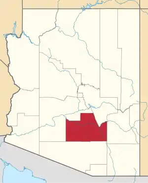 | |
| Towns | ||
| CDPs |
| |
| Populated places | ||
| Indian reservations | ||
| Ghost towns | ||
| Footnotes | ‡This populated place also has portions in an adjacent county or counties | |
This article is issued from Wikipedia. The text is licensed under Creative Commons - Attribution - Sharealike. Additional terms may apply for the media files.