La Chambonie | |
|---|---|
Commune | |
 | |
Location of La Chambonie | |
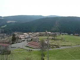
 La Chambonie  La Chambonie | |
| Coordinates: 45°44′53″N 3°44′58″E / 45.7481°N 3.7494°E | |
| Country | France |
| Region | Auvergne-Rhône-Alpes |
| Department | Loire |
| Arrondissement | Montbrison |
| Canton | Boën-sur-Lignon |
| Intercommunality | CA Loire Forez |
| Government | |
| • Mayor (2020–2026) | François Forchez[1] |
| Area 1 | 4.42 km2 (1.71 sq mi) |
| Population | 38 |
| • Density | 8.6/km2 (22/sq mi) |
| Time zone | UTC+01:00 (CET) |
| • Summer (DST) | UTC+02:00 (CEST) |
| INSEE/Postal code | 42045 /42440 |
| Elevation | 940–1,383 m (3,084–4,537 ft) (avg. 1,020 m or 3,350 ft) |
| 1 French Land Register data, which excludes lakes, ponds, glaciers > 1 km2 (0.386 sq mi or 247 acres) and river estuaries. | |
La Chambonie (French pronunciation: [la ʃɑ̃bɔni]) is a commune in the Loire department in central France.
Population
| Year | Pop. | ±% p.a. |
|---|---|---|
| 1968 | 102 | — |
| 1975 | 81 | −3.24% |
| 1982 | 79 | −0.36% |
| 1990 | 55 | −4.43% |
| 1999 | 46 | −1.97% |
| 2009 | 64 | +3.36% |
| 2014 | 46 | −6.39% |
| 2020 | 39 | −2.71% |
| Source: INSEE[3] | ||
See also
References
- ↑ "Répertoire national des élus: les maires". data.gouv.fr, Plateforme ouverte des données publiques françaises (in French). 9 August 2021.
- ↑ "Populations légales 2021". The National Institute of Statistics and Economic Studies. 28 December 2023.
- ↑ Population en historique depuis 1968, INSEE
Wikimedia Commons has media related to La Chambonie.
This article is issued from Wikipedia. The text is licensed under Creative Commons - Attribution - Sharealike. Additional terms may apply for the media files.