Planfoy | |
|---|---|
Commune | |
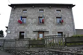 Town hall | |
Location of Planfoy | |
 Planfoy  Planfoy | |
| Coordinates: 45°23′02″N 4°26′29″E / 45.3839°N 4.4414°E | |
| Country | France |
| Region | Auvergne-Rhône-Alpes |
| Department | Loire |
| Arrondissement | Saint-Étienne |
| Canton | Le Pilat |
| Intercommunality | Monts du Pilat |
| Government | |
| • Mayor (2020–2026) | Cédric Loubet[1] |
| Area 1 | 12.27 km2 (4.74 sq mi) |
| Population | 1,070 |
| • Density | 87/km2 (230/sq mi) |
| Time zone | UTC+01:00 (CET) |
| • Summer (DST) | UTC+02:00 (CEST) |
| INSEE/Postal code | 42172 /42660 |
| Elevation | 597–1,099 m (1,959–3,606 ft) (avg. 963 m or 3,159 ft) |
| 1 French Land Register data, which excludes lakes, ponds, glaciers > 1 km2 (0.386 sq mi or 247 acres) and river estuaries. | |
Planfoy (French pronunciation: [plɑ̃fwa]) is a commune in the Loire department in central France.
Population
| Year | Pop. | ±% p.a. |
|---|---|---|
| 1968 | 417 | — |
| 1975 | 536 | +3.65% |
| 1982 | 707 | +4.03% |
| 1990 | 778 | +1.20% |
| 1999 | 852 | +1.01% |
| 2009 | 896 | +0.50% |
| 2014 | 1,009 | +2.40% |
| 2020 | 1,062 | +0.86% |
| Source: INSEE[3] | ||
See also
References
- ↑ "Répertoire national des élus: les maires". data.gouv.fr, Plateforme ouverte des données publiques françaises (in French). 9 August 2021.
- ↑ "Populations légales 2021". The National Institute of Statistics and Economic Studies. 28 December 2023.
- ↑ Population en historique depuis 1968, INSEE
Wikimedia Commons has media related to Planfoy.
This article is issued from Wikipedia. The text is licensed under Creative Commons - Attribution - Sharealike. Additional terms may apply for the media files.