Landerrouet-sur-Ségur | |
|---|---|
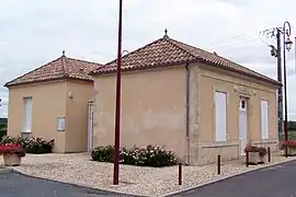 Town hall | |
Location of Landerrouet-sur-Ségur | |
 Landerrouet-sur-Ségur  Landerrouet-sur-Ségur | |
| Coordinates: 44°39′15″N 0°01′18″W / 44.6542°N 0.0217°W | |
| Country | France |
| Region | Nouvelle-Aquitaine |
| Department | Gironde |
| Arrondissement | Langon |
| Canton | Le Réolais et Les Bastides |
| Government | |
| • Mayor (2020–2026) | Jean-Pierre Gasnault[1] |
| Area 1 | 3.14 km2 (1.21 sq mi) |
| Population | 102 |
| • Density | 32/km2 (84/sq mi) |
| Time zone | UTC+01:00 (CET) |
| • Summer (DST) | UTC+02:00 (CEST) |
| INSEE/Postal code | 33224 /33540 |
| Elevation | 14–82 m (46–269 ft) (avg. 50 m or 160 ft) |
| 1 French Land Register data, which excludes lakes, ponds, glaciers > 1 km2 (0.386 sq mi or 247 acres) and river estuaries. | |
Landerrouet-sur-Ségur is a commune in the Gironde department in Nouvelle-Aquitaine in southwestern France.
Population
| Year | Pop. | ±% |
|---|---|---|
| 1962 | 91 | — |
| 1968 | 115 | +26.4% |
| 1975 | 109 | −5.2% |
| 1982 | 117 | +7.3% |
| 1990 | 115 | −1.7% |
| 1999 | 108 | −6.1% |
| 2008 | 119 | +10.2% |
See also
References
- ↑ "Répertoire national des élus: les maires". data.gouv.fr, Plateforme ouverte des données publiques françaises (in French). 2 December 2020.
- ↑ "Populations légales 2021". The National Institute of Statistics and Economic Studies. 28 December 2023.
Wikimedia Commons has media related to Landerrouet-sur-Ségur.
This article is issued from Wikipedia. The text is licensed under Creative Commons - Attribution - Sharealike. Additional terms may apply for the media files.