Lanton | |
|---|---|
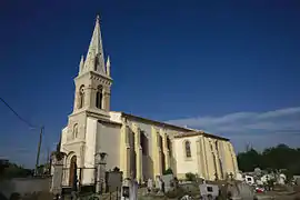 The church in Lanton | |
.svg.png.webp) Coat of arms | |
Location of Lanton | |
 Lanton  Lanton | |
| Coordinates: 44°42′17″N 1°02′03″W / 44.7047°N 1.0342°W | |
| Country | France |
| Region | Nouvelle-Aquitaine |
| Department | Gironde |
| Arrondissement | Arcachon |
| Canton | Andernos-les-Bains |
| Intercommunality | CA Bassin d'Arcachon Nord |
| Government | |
| • Mayor (2020–2026) | Marie Larrue[1] |
| Area 1 | 136.19 km2 (52.58 sq mi) |
| Population | 7,276 |
| • Density | 53/km2 (140/sq mi) |
| Time zone | UTC+01:00 (CET) |
| • Summer (DST) | UTC+02:00 (CEST) |
| INSEE/Postal code | 33229 /33138 |
| Elevation | 1–54 m (3.3–177.2 ft) |
| 1 French Land Register data, which excludes lakes, ponds, glaciers > 1 km2 (0.386 sq mi or 247 acres) and river estuaries. | |
Lanton (French pronunciation: [lɑ̃tɔ̃]; Occitan: Lenton) is a commune in the Gironde department in Nouvelle-Aquitaine in southwestern France.
Population
|
| ||||||||||||||||||||||||||||||||||||||||||
| Source: EHESS[3] and INSEE (1968-2017)[4] | |||||||||||||||||||||||||||||||||||||||||||
See also
References
- ↑ "Répertoire national des élus: les maires". data.gouv.fr, Plateforme ouverte des données publiques françaises (in French). 9 August 2021.
- ↑ "Populations légales 2021". The National Institute of Statistics and Economic Studies. 28 December 2023.
- ↑ Des villages de Cassini aux communes d'aujourd'hui: Commune data sheet Lanton, EHESS (in French).
- ↑ Population en historique depuis 1968, INSEE
Wikimedia Commons has media related to Lanton (Gironde).
This article is issued from Wikipedia. The text is licensed under Creative Commons - Attribution - Sharealike. Additional terms may apply for the media files.