List of airports in the Lethbridge area is located in Lethbridge
CYQL
CYQL
CLH4
CLH4
CGN3
CGN3
CLJ3
CLJ3
CMF3
CMF3
CTF6
CTF6
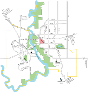
Location in Lethbridge (not including CGN3 and CMF3)

The following active airports serve the area around Lethbridge, Alberta, Canada:[1]

Airport name ICAO/TC LID (IATA) Location Coordinates
Lethbridge AirportCYQL (YQL)Lethbridge49°37′49″N 112°47′59″W / 49.63028°N 112.79972°W / 49.63028; -112.79972 (Lethbridge County Airport)
Lethbridge (Chinook Regional Hospital) HeliportCLH4Lethbridge49°41′09″N 112°49′00″W / 49.68583°N 112.81667°W / 49.68583; -112.81667 (Lethbridge (Chinook Regional Hospital) Heliport)
Lethbridge (Gunnlaugson) AerodromeCGN3Lethbridge49°38′10″N 112°41′29″W / 49.63611°N 112.69139°W / 49.63611; -112.69139 (Lethbridge (Gunnlaugson) Aerodrome)
Lethbridge (J3 Airfield) AerodromeCLJ3Lethbridge49°44′30″N 112°44′22″W / 49.74167°N 112.73944°W / 49.74167; -112.73944 (Lethbridge (J3 Airfield) Aerodrome)
Lethbridge (Mercer Field) AerodromeCMF3Lethbridge49°33′17″N 112°33′49″W / 49.55472°N 112.56361°W / 49.55472; -112.56361 (Lethbridge (Mercer Field) Aerodrome)
Lethbridge (Taylor Field) AerodromeCTF6Lethbridge49°42′58″N 112°45′02″W / 49.71611°N 112.75056°W / 49.71611; -112.75056 (Lethbridge (Taylor Field) Aerodrome)

See also

References

  1. Canada Flight Supplement. Effective 0901Z 16 July 2020 to 0901Z 10 September 2020.
This article is issued from Wikipedia. The text is licensed under Creative Commons - Attribution - Sharealike. Additional terms may apply for the media files.