CYND
CYOW
CNR6
CYRP
CPL3
CSF7
CPR2
CHF2
CYRO
CYSH
CNQ5
CTR7
CRB7
CPN7
CTA9
CPK7
CPP7
CYDH
CQH2
CWH4
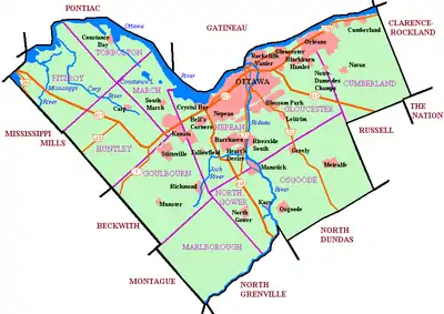
Location in the Ottawa area
Ottawa
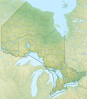
Location in Ontario
The following active airports serve the area around Ottawa, Ontario, Canada, lying under or adjacent to Ottawa's terminal control area:[1][2]
Land airports
Scheduled commercial airline service
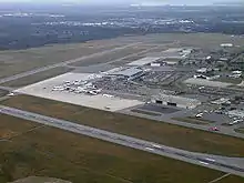
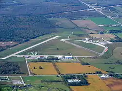
Ottawa Macdonald–Cartier International Airport
Gatineau-Ottawa Executive Airport
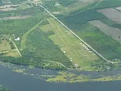
Carp Airport
Kars/Rideau Valley Air Park
| Airport name | ICAO/TC LID/IATA | Location | Coordinates |
|---|---|---|---|
| Ottawa Macdonald–Cartier International Airport | CYOW (YOW) | Ottawa | 45°19′21″N 075°40′09″W / 45.32250°N 75.66917°W |
Other
Macdonald-Cartier handles all of the scheduled passenger service for Ottawa, in addition to a large amount of general aviation and some military traffic. The remaining airports serve almost exclusively general aviation. Macdonald-Cartier, Gatineau, Carp, Smiths Falls, and Arnprior have instrument approaches and winter maintenance for year-round, all-weather operations.
Water aerodromes
Heliports
See also
- List of airports in the Bala, Ontario area
- List of airports in the Bracebridge area
- List of airports in the Fergus area
- List of airports in the London, Ontario area
- List of airports in the Parry Sound area
- List of airports in the Port Carling area
- List of airports in the Sault Ste. Marie, Ontario area
- List of airports in the Thunder Bay area
- List of airports in the Greater Toronto Area
References
- ↑ Canada Flight Supplement. Effective 0901Z 16 July 2020 to 0901Z 10 September 2020.
- ↑ Nav Canada's Water Aerodrome Supplement. Effective 0901Z 26 March 2020 to 0901Z 22 April 2021.
| By name | |
|---|---|
| By location indicator | |
| By province/territory | |
| By area | |
| National Airports System | |
| Related | |
| |
This article is issued from Wikipedia. The text is licensed under Creative Commons - Attribution - Sharealike. Additional terms may apply for the media files.