Luppé-Violles | |
|---|---|
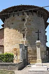 The church in Luppé-Violles | |
Location of Luppé-Violles | |
 Luppé-Violles  Luppé-Violles | |
| Coordinates: 43°44′24″N 0°07′55″W / 43.74°N 0.1319°W | |
| Country | France |
| Region | Occitania |
| Department | Gers |
| Arrondissement | Condom |
| Canton | Grand-Bas-Armagnac |
| Intercommunality | Bas-Armagnac |
| Government | |
| • Mayor (2020–2026) | David Lacoste[1] |
| Area 1 | 7.57 km2 (2.92 sq mi) |
| Population | 135 |
| • Density | 18/km2 (46/sq mi) |
| Time zone | UTC+01:00 (CET) |
| • Summer (DST) | UTC+02:00 (CEST) |
| INSEE/Postal code | 32220 /32110 |
| Elevation | 96–166 m (315–545 ft) (avg. 141 m or 463 ft) |
| 1 French Land Register data, which excludes lakes, ponds, glaciers > 1 km2 (0.386 sq mi or 247 acres) and river estuaries. | |
Luppé-Violles (French pronunciation: [lype vjɔl]; Occitan: Lupèr e Viòlas) is a commune in the Gers department in southwestern France.
Geography

Luppé-Violles and its surrounding communes
Population
| Year | Pop. | ±% |
|---|---|---|
| 1962 | 181 | — |
| 1968 | 172 | −5.0% |
| 1975 | 150 | −12.8% |
| 1982 | 136 | −9.3% |
| 1990 | 129 | −5.1% |
| 1999 | 125 | −3.1% |
| 2008 | 141 | +12.8% |
See also
References
- ↑ "Répertoire national des élus: les maires". data.gouv.fr, Plateforme ouverte des données publiques françaises (in French). 9 August 2021.
- ↑ "Populations légales 2021". The National Institute of Statistics and Economic Studies. 28 December 2023.
Wikimedia Commons has media related to Luppé-Violles.
This article is issued from Wikipedia. The text is licensed under Creative Commons - Attribution - Sharealike. Additional terms may apply for the media files.