Merckeghem | |
|---|---|
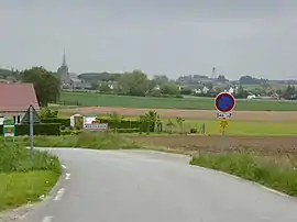 The road into Merckeghem | |
_Nord-France.svg.png.webp) Coat of arms | |
Location of Merckeghem | |
 Merckeghem  Merckeghem | |
| Coordinates: 50°51′44″N 2°17′48″E / 50.8622°N 2.2967°E | |
| Country | France |
| Region | Hauts-de-France |
| Department | Nord |
| Arrondissement | Dunkerque |
| Canton | Wormhout |
| Intercommunality | Hauts de Flandre |
| Government | |
| • Mayor (2020–2026) | Danielle Vanmaele[1] |
| Area 1 | 10.73 km2 (4.14 sq mi) |
| Population | 614 |
| • Density | 57/km2 (150/sq mi) |
| Demonym | Merckeghemois |
| Time zone | UTC+01:00 (CET) |
| • Summer (DST) | UTC+02:00 (CEST) |
| INSEE/Postal code | 59397 /59470 |
| Elevation | 0–63 m (0–207 ft) (avg. 62 m or 203 ft) |
| 1 French Land Register data, which excludes lakes, ponds, glaciers > 1 km2 (0.386 sq mi or 247 acres) and river estuaries. | |
Merckeghem (French pronunciation: [mɛʁkəɡɛm]; Dutch: Merckegem) is a commune in the Nord department in northern France.[3]
Heraldry
Arms of Merckeghem |
The arms of Merckeghem are blazoned : Or, 2 croziers in saltire respectant gules, between 3 corbies sable and a mount vert.
|
See also
References
- ↑ "Répertoire national des élus: les maires" (in French). data.gouv.fr, Plateforme ouverte des données publiques françaises. 13 September 2022.
- ↑ "Populations légales 2021". The National Institute of Statistics and Economic Studies. 28 December 2023.
- ↑ INSEE commune file
Wikimedia Commons has media related to Merckeghem.
This article is issued from Wikipedia. The text is licensed under Creative Commons - Attribution - Sharealike. Additional terms may apply for the media files.