| Woodhead Dam | |
|---|---|
 Woodhead Dam | |
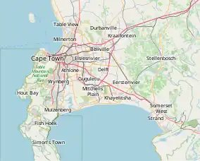
 Location of Woodhead Dam in Cape Town | |
| Location | Table Mountain, Western Cape, South Africa |
| Coordinates | 33°58′35″S 18°24′08″E / 33.97639°S 18.40222°E |
| Construction began | 1894 |
| Opening date | 1897 |
| Owner(s) | Cape Town Municipality |
| Dam and spillways | |
| Type of dam | Masonry gravity dam |
| Impounds | Disa Stream |
| Height | 50 m (164 ft) |
| Length | 277 m (909 ft)[1] |
| Spillway type | Free overspill |
| Spillway capacity | 20 m3/s (706 ft3/s) |
| Reservoir | |
| Creates | Woodhead Reservoir |
| Total capacity | 927,000 m3 (32,737,000 cu ft) |
| Surface area | 13 ha (32 acres) |
Woodhead Dam is a dam on Table Mountain, Western Cape, South Africa. It was built in 1897 and supplies water to Cape Town. The dam, which was the first large masonry dam in South Africa, was designated as an International Historic Civil Engineering Landmark by the American Society of Civil Engineers in 2008.[2]
History

In 1870, the growth of Cape Town led to shortages of drinking water. It was decided to build a reservoir on Table Mountain to provide water to the city. Scottish hydraulic engineer Thomas Stewart was engaged to design and build the reservoir.[2]
The Woodhead Tunnel was built between 1888 and 1891. It was used to divert the Disa Stream, a tributary of the Hout Bay River, westward to provide water for the reservoir.
An aerial cableway was constructed to transport men and materials to the construction site.[2][3] The dam was constructed between 1894 and 1897. This dam was followed by four others in the area. The Hely-Hutchinson Dam and reservoir were built by 1904 just upstream of the Woodhead reservoir. The Alexandra Dam and Victoria Dam were built on the original Disa Stream by 1903. The last of the five dams was the De Villiers Dam in 1907. This was built downstream of the Alexandra and Victoria Dams. Today, these five dams supply around 0.4% of the water for Cape Town.[4]
Design
The Woodhead Tunnel is 640 m (2,100 ft) long. The Woodhead Dam is a masonry gravity dam that is 277 m (909 ft) long and 50 m (164 ft) high. It has a free overspill spillway with a capacity of 20 m3/s (706 ft3/s). The reservoir has a capacity of 927,000 m3 (32,737,000 cu ft) and a surface area of 13 ha (32 acres).[1]
See also
References
- 1 2 "South African Large Dams". South African Large Dams-1-2009 v3.0.xls. SANCOLD. January 2009. Archived from the original (zip) on 5 July 2009. Retrieved 5 March 2010.
- 1 2 3 "Led by ASCE President, Delegation Visits S. Africa To Honor Dam as Civil Engineering Landmark". ASCE International Page. American Society of Civil Engineers. Archived from the original on 25 July 2011. Retrieved 6 March 2010.
- ↑ Murray, Tony. "Thomas Steweart - First South African Consulting Engineer" (PDF). American Society of Civil Engineers. Archived from the original (PDF) on 25 July 2011. Retrieved 6 March 2010.
- ↑ River Health Programme (2003). State-of-Rivers Report: Diep, Hout Bay, Lourens and Palmiet River Systems (PDF), Pretoria: Department of Water Affairs and Forestry, 2003, pp. 17–18, archived from the original (PDF) on 2010-02-14, retrieved 2010-03-28
