Ambalakida | |
|---|---|
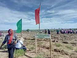 planting trees in Marohogo, a village of Ambalakida | |
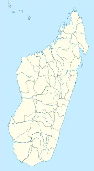 Ambalakida Location in Madagascar | |
| Coordinates: 15°47′S 46°35′E / 15.783°S 46.583°E | |
| Country | |
| Region | Boeny |
| District | Mahajanga II |
| Elevation | 70 m (230 ft) |
| Population (2001)[2] | |
| • Total | 5,000 |
| Time zone | UTC3 (EAT) |
| Postal code | 402 |
Ambalakida is a rural municipality in Madagascar. It belongs to the district of Mahajanga II, which is a part of Boeny Region.[3] The population of the commune was estimated to be approximately 5,000 in 2001 commune census.[2]
Industry
There is a sugar cane mill in Antanamifafy, a village that belongs to this municipality.[4]
References and notes
- ↑ Estimated based on DEM data from Shuttle Radar Topography Mission
- 1 2 "ILO census data". Cornell University. 2002. Retrieved 2008-03-03.
- ↑ "Ambalakida Map on Maplandia".
- ↑ Sucrerie d'Antanamifafy
Capital: Mahajanga | ||
| Ambato-Boeni (11) (403) |  | |
| Mahajanga (1) | ||
| Mahajanga II (9) (402) | ||
| Marovoay (12) (416) | ||
| Mitsinjo (7) (417) | ||
| Soalala (3) (420) | ||
6 districts; 43 communes | ||
15°47′S 46°35′E / 15.783°S 46.583°E
This article is issued from Wikipedia. The text is licensed under Creative Commons - Attribution - Sharealike. Additional terms may apply for the media files.