Marovoay District | |
|---|---|
District | |
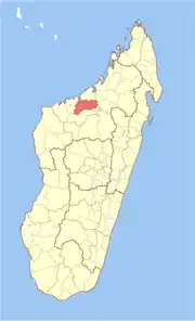 Location in Madagascar | |
| Coordinates: 16°9′S 46°37′E / 16.150°S 46.617°E | |
| Country | |
| Region | Boeny |
| Area | |
| • Total | 3,804 km2 (1,469 sq mi) |
| Population (2013) | |
| • Total | 182,742 |
| • Density | 48/km2 (120/sq mi) |
| Time zone | UTC3 (EAT) |
Marovoay is a district in northwestern Madagascar. It is a part of Boeny Region and borders the districts of Mahajanga II in north, Boriziny and Mampikony in east, Ambato-Boeni in south and Mitsinjo in west. The area is 3,804 km2 (1,469 sq mi) and the population was estimated to be 182,742 in 2013.[1]
Communes
The district is further divided into 12 communes:
Rivers
The Betsiboka River.
References and notes
- ↑ Institut National de la Statistique, Madagascar.
16°9′S 46°37′E / 16.150°S 46.617°E
Capital: Mahajanga | ||
| Ambato-Boeni (11) (403) |  | |
| Mahajanga (1) | ||
| Mahajanga II (9) (402) | ||
| Marovoay (12) (416) | ||
| Mitsinjo (7) (417) | ||
| Soalala (3) (420) | ||
6 districts; 43 communes | ||
This article is issued from Wikipedia. The text is licensed under Creative Commons - Attribution - Sharealike. Additional terms may apply for the media files.