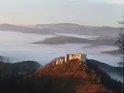
Bánovce nad Bebravou District | |
|---|---|
 | |
| Country | Slovakia |
| Region (kraj) | Trenčín Region |
| Area | |
| • Total | 462 km2 (178 sq mi) |
| Population (2008) | |
| • Total | 38,046 |
| • Density | 82/km2 (210/sq mi) |
| Time zone | UTC+01:00 (CET) |
| • Summer (DST) | UTC+02:00 (CEST) |
| Telephone prefix | 38 |
Bánovce nad Bebravou District (Slovak: okres Bánovce nad Bebravou, Hungarian: Báni járás) is a district in the Trenčín Region of western Slovakia. Until 1918, the district was mostly part of the county of Kingdom of Hungary of Trencsén, except for a small area in the south which formed part of the county of Nyitra.
Municipalities
| Municipality | Area (km2)[1] | Population[2][3] |
|---|---|---|
| Bánovce nad Bebravou | 14.02 | 907 ( |
| Borčany | 3.1 | 264 ( |
| Brezolupy | 6.33 | 516 ( |
| Chudá Lehota | 3.66 | 224 ( |
| Čierna Lehota | 15.2 | 108 ( |
| Cimenná | 3.59 | 101 ( |
| Dežerice | 13.03 | 1,033 ( |
| Dolné Naštice | 4.63 | 580 ( |
| Dubnička | 8.1 | 128 ( |
| Dvorec | 2.66 | 463 ( |
| Haláčovce | 4.68 | 370 ( |
| Horné Naštice | 8.56 | 511 ( |
| Krásna Ves | 10.21 | 503 ( |
| Kšinná | 41.24 | 487 ( |
| Libichava | 2.62 | 141 ( |
| Ľutov | 8.57 | 170 ( |
| Malá Hradná | 7.9 | 397 ( |
| Malé Hoste | 6.81 | 399 ( |
| Miezgovce | 8.75 | 286 ( |
| Nedašovce | 6.91 | 438 ( |
| Omastiná | 12.44 | 42 ( |
| Otrhánky | 4.65 | 392 ( |
| Pečeňany | 6.62 | 520 ( |
| Pochabany | 4.31 | 263 ( |
| Podlužany | 14.02 | 907 ( |
| Pravotice | 6.04 | 345 ( |
| Prusy | 7.51 | 623 ( |
| Ruskovce | 3.35 | 521 ( |
| Rybany | 11.04 | 1,480 ( |
| Slatina nad Bebravou | 11.52 | 444 ( |
| Slatinka nad Bebravou | 9.53 | 192 ( |
| Šípkov | 11.55 | 145 ( |
| Šišov | 9.63 | 511 ( |
| Timoradza | 10.48 | 514 ( |
| Trebichava | 11.76 | 39 ( |
| Uhrovec | 22.94 | 1,488 ( |
| Uhrovské Podhradie | 12.52 | 35 ( |
| Veľké Chlievany | 5.14 | 506 ( |
| Veľké Držkovce | 12.78 | 660 ( |
| Veľké Hoste | 8.25 | 565 ( |
| Vysočany | 4.32 | 109 ( |
| Žitná-Radiša | 17.76 | 445 ( |
| Zlatníky | 50.43 | 690 ( |
References
- ↑ "Statistic of Slovak places by Dušan Kreheľ – Export". Archived from the original on 2021-06-27. Retrieved 2021-07-05.
- ↑ "Statistic of Slovak places by Dušan Kreheľ – Export". Archived from the original on 2021-07-19. Retrieved 2021-07-19.
- ↑ "Statistic of Slovak places by Dušan Kreheľ – Export". Archived from the original on 2021-09-01. Retrieved 2021-09-01.
External links
48°39′9″N 18°15′33″E / 48.65250°N 18.25917°E
This article is issued from Wikipedia. The text is licensed under Creative Commons - Attribution - Sharealike. Additional terms may apply for the media files.