Balangan Regency (Kabupaten Balangan) | |
|---|---|
|
Coat of arms | |
| Motto: Sanggam | |
 | |
| Country | Indonesia |
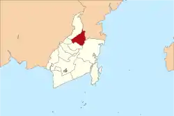
| Province | South Kalimantan |
| Capital | Paringin |
| Area | |
| • Total | 1,828.51 km2 (705.99 sq mi) |
| Population (mid 2022 estimate) | |
| • Total | 134,512 |
| • Density | 74/km2 (190/sq mi) |
| [1] | |
| Time zone | UTC+8 (WITA) |
| Website | balangankab.go.id |
Balangan Regency is one of the regencies in the Indonesian province of South Kalimantan. It was created on 25 February 2003 from what were previously the eastern districts of North Hulu Sungai Regency. It now covers an area of 1,828.51 km2, and had a population of 112,430 at the 2010 Census[2] and 130,355 at the 2020 Census;[3] the official estimate as at mid 2022 was 134,512, consisting of 67,958 males and 66,554 females.[1] The capital is Paringin. Motto: "Sanggam" (Banjarese), also an acronym for "Sanggup Bagawi Gasan Masyarakat" (Banjarese="Willing To Work for the Sake of the People").
Administrative Districts
Balangan Regency consists of eight districts (kecamatan), tabulated below with their areas and population totals from the 2010 Census,[2] and 2020 Census,[3] together with the official estimates for mid 2022.[1] The table also includes the location of the district administrative centres, the number of administrative villages in each district (a total of 154 rural desa and 3 urban kelurahan), and its postal codes.
| Kode Wilayah | Name of District (kecamatan) | Area in km2 | Pop'n Census 2010 | Pop'n Census 2020 | Pop'n Estimate mid 2022 | Admin centre | No. of villages | Post codes |
|---|---|---|---|---|---|---|---|---|
| 63.11.05 | Lampihong | 96.96 | 15,748 | 18,282 | 18,861 | Lampihong Kiri | 27 | 71661 |
| 63.11.04 | Batu Mandi | 147.96 | 16,129 | 18,831 | 19,448 | Batumandi | 18 | 71663 |
| 63.11.03 | Awayan | 142.57 | 12,048 | 13,775 | 14,169 | Putat Basiun | 23 | 71664 |
| 63.11.08 | Tebing Tinggi | 257.25 | 5,918 | 7,073 | 7,338 | Tebing Tinggi | 12 | 71667 |
| 63.11.06 | Paringin | 100.04 | 16,844 | 19,701 | 20,354 | Paringin Kota | 16 (a) | 71662 (b) |
| 63.11.07 | Paringin Selatan (South Paringin) | 86.80 | 11,436 | 15,462 | 16,429 | Batu Piring | 16 (c) | 71662 (d) |
| 63.11.01 | Juai | 386.88 | 15,695 | 16,801 | 17,063 | Mungkur Uyam | 21 | 71665 |
| 63.11.02 | Halong | 659.84 | 18,612 | 20,340 | 20,850 | Halong | 24 | 71666 |
| Totals | 1,828.51 | 112,430 | 130,355 | 134,512 | Paringin Kota | 157 |
Notes: (a) including 2 kelurahan - Paringin Kota and Paringin Timur. (b) except the villages of Mangkayahu (postcode of 71614) and Layap (postcode of 71616).
(c) including one kelurahan - Batu Piring. (d) except the village of Bungin (postcode of 71617) and the town of Batu Piring (postcode of 71618).
Climate
Paringin, the seat of the regency has a tropical rainforest climate (Af) with heavy rainfall year-round.
| Climate data for Paringin | |||||||||||||
|---|---|---|---|---|---|---|---|---|---|---|---|---|---|
| Month | Jan | Feb | Mar | Apr | May | Jun | Jul | Aug | Sep | Oct | Nov | Dec | Year |
| Mean daily maximum °C (°F) | 29.5 (85.1) |
30.0 (86.0) |
30.3 (86.5) |
30.6 (87.1) |
30.6 (87.1) |
30.3 (86.5) |
30.2 (86.4) |
30.9 (87.6) |
31.1 (88.0) |
31.3 (88.3) |
30.6 (87.1) |
30.0 (86.0) |
30.5 (86.8) |
| Daily mean °C (°F) | 26.0 (78.8) |
26.3 (79.3) |
26.6 (79.9) |
26.8 (80.2) |
26.8 (80.2) |
26.4 (79.5) |
26.1 (79.0) |
26.6 (79.9) |
26.7 (80.1) |
27.0 (80.6) |
26.7 (80.1) |
26.4 (79.5) |
26.5 (79.8) |
| Mean daily minimum °C (°F) | 22.6 (72.7) |
22.7 (72.9) |
22.9 (73.2) |
23.0 (73.4) |
23.1 (73.6) |
22.5 (72.5) |
22.1 (71.8) |
22.3 (72.1) |
22.4 (72.3) |
22.7 (72.9) |
22.8 (73.0) |
22.8 (73.0) |
22.7 (72.8) |
| Average rainfall mm (inches) | 274 (10.8) |
265 (10.4) |
249 (9.8) |
219 (8.6) |
195 (7.7) |
152 (6.0) |
129 (5.1) |
102 (4.0) |
126 (5.0) |
148 (5.8) |
240 (9.4) |
308 (12.1) |
2,407 (94.7) |
| Source: Climate-Data.org[4] | |||||||||||||
References
External links
Regencies and cities of South Kalimantan | ||
|---|---|---|
Capital: Banjarbaru | ||
| Regencies | ||
| Cities | ||