Biei
美瑛町 | |
|---|---|
Town | |
 | |
 Flag  Emblem | |
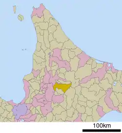 Location of Biei in Hokkaido (Kamikawa Subprefecture) | |
 Biei Location in Japan | |
| Coordinates: 43°35′N 142°28′E / 43.583°N 142.467°E | |
| Country | Japan |
| Region | Hokkaido |
| Prefecture | Hokkaido (Kamikawa Subprefecture) |
| District | Kamikawa (Ishikari) |
| Government | |
| • Mayor | Satoshi Hamada |
| Area | |
| • Total | 677.16 km2 (261.45 sq mi) |
| Population (September 30, 2016) | |
| • Total | 10,374 |
| • Density | 15/km2 (40/sq mi) |
| Time zone | UTC+09:00 (JST) |
| City hall address | 4-6-1 Motomachi, Biei-chō, Kamikawa-gun, Hokkaidō 071-0292 |
| Website | www |
| Symbols | |
| Flower | Lily of the Valley |
| Tree | Japanese White Birch |
Biei (美瑛町, Biei-chō) is a town located in Kamikawa Subprefecture, Hokkaido, Japan. As of September 2016, the town has an estimated population of 10,374, and a density of 15 persons per km2. The total area is 677.16 km2.
Overview
Biei is famous for its views of wide fields and hills, and is used as a backdrop for many Japanese commercials and TV programmes. The bright colours of its fields attract thousands of visitors in July and August.
The town also houses the Shinzo Maeda Photo Art Gallery.
Since 1992, Biei has held the "Biei Healthy Marathon", which attracts runners from all around Japan.[1]
Climate
| Climate data for Biei, Hokkaido (1991−2020 normals, extremes 1977−present) | |||||||||||||
|---|---|---|---|---|---|---|---|---|---|---|---|---|---|
| Month | Jan | Feb | Mar | Apr | May | Jun | Jul | Aug | Sep | Oct | Nov | Dec | Year |
| Record high °C (°F) | 6.0 (42.8) |
11.4 (52.5) |
14.9 (58.8) |
27.0 (80.6) |
34.4 (93.9) |
36.0 (96.8) |
36.1 (97.0) |
37.1 (98.8) |
32.7 (90.9) |
25.7 (78.3) |
20.2 (68.4) |
12.1 (53.8) |
37.1 (98.8) |
| Mean daily maximum °C (°F) | −3.9 (25.0) |
−2.6 (27.3) |
2.0 (35.6) |
10.2 (50.4) |
18.0 (64.4) |
22.3 (72.1) |
25.7 (78.3) |
25.8 (78.4) |
21.3 (70.3) |
14.2 (57.6) |
5.6 (42.1) |
−1.6 (29.1) |
11.4 (52.6) |
| Daily mean °C (°F) | −8.7 (16.3) |
−7.9 (17.8) |
−3.0 (26.6) |
4.4 (39.9) |
11.3 (52.3) |
15.9 (60.6) |
19.7 (67.5) |
20.0 (68.0) |
15.2 (59.4) |
8.3 (46.9) |
1.5 (34.7) |
−5.5 (22.1) |
5.9 (42.7) |
| Mean daily minimum °C (°F) | −14.8 (5.4) |
−14.7 (5.5) |
−9.1 (15.6) |
−1.3 (29.7) |
4.7 (40.5) |
10.0 (50.0) |
14.7 (58.5) |
15.2 (59.4) |
9.8 (49.6) |
3.0 (37.4) |
−2.9 (26.8) |
−10.8 (12.6) |
0.3 (32.6) |
| Record low °C (°F) | −33.2 (−27.8) |
−32.7 (−26.9) |
−27.5 (−17.5) |
−14.2 (6.4) |
−4.7 (23.5) |
−0.9 (30.4) |
3.8 (38.8) |
4.7 (40.5) |
−0.6 (30.9) |
−6.0 (21.2) |
−20.8 (−5.4) |
−27.3 (−17.1) |
−33.2 (−27.8) |
| Average precipitation mm (inches) | 41.1 (1.62) |
38.3 (1.51) |
47.0 (1.85) |
49.5 (1.95) |
68.5 (2.70) |
69.5 (2.74) |
121.2 (4.77) |
168.3 (6.63) |
129.0 (5.08) |
96.0 (3.78) |
94.5 (3.72) |
73.5 (2.89) |
996.4 (39.24) |
| Average snowfall cm (inches) | 164 (65) |
141 (56) |
129 (51) |
28 (11) |
0 (0) |
0 (0) |
0 (0) |
0 (0) |
0 (0) |
3 (1.2) |
79 (31) |
182 (72) |
726 (287.2) |
| Average rainy days | 15.2 | 13.1 | 13.6 | 11.4 | 11.0 | 9.9 | 10.9 | 11.7 | 12.3 | 14.1 | 17.9 | 18.2 | 159.3 |
| Average snowy days | 21.1 | 18.8 | 17.0 | 3.3 | 0 | 0 | 0 | 0 | 0 | 0.4 | 8.2 | 21.1 | 89.9 |
| Mean monthly sunshine hours | 67.5 | 83.2 | 122.1 | 154.0 | 181.5 | 166.0 | 161.6 | 156.2 | 149.8 | 123.4 | 60.1 | 47.9 | 1,473.3 |
| Source 1: JMA[2] | |||||||||||||
| Source 2: JMA[3] | |||||||||||||
Gallery
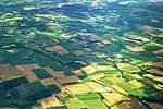 The Patchwork Road
 Tree of "Ken and Merry"
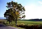 Tree of a parent and a child
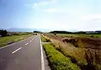


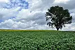 Tree of philosophy
References
- ↑ Biei Healthy Marathon official website Main page Archived 2011-06-25 at the Wayback Machine (in Japanese)
- ↑ 観測史上1~10位の値(年間を通じての値). JMA. Retrieved February 17, 2022.
- ↑ 気象庁 / 平年値(年・月ごとの値). JMA. Retrieved February 17, 2022.
External links
 Media related to Biei, Hokkaidō at Wikimedia Commons
 Biei travel guide from Wikivoyage
- Official Website (in Japanese)
This article is issued from Wikipedia. The text is licensed under Creative Commons - Attribution - Sharealike. Additional terms may apply for the media files.