Tsurui
鶴居村 | |
|---|---|
Village | |
 Tsurui village hall | |
 Flag  Seal | |
 Location of Tsurui in Hokkaido (Kushiro Subprefecture) | |
 Tsurui Location in Japan | |
| Coordinates: 43°14′N 144°19′E / 43.233°N 144.317°E | |
| Country | Japan |
| Region | Hokkaido |
| Prefecture | Hokkaido (Kushiro Subprefecture) |
| District | Akan |
| Area | |
| • Total | 571.84 km2 (220.79 sq mi) |
| Population (September 30, 2016) | |
| • Total | 2,516 |
| • Density | 4.4/km2 (11/sq mi) |
| Time zone | UTC+09:00 (JST) |
| Climate | Dfb |
| Website | www |
Tsurui (鶴居村, Tsurui-mura) is a village located in Kushiro Subprefecture, Hokkaido. As of September 30, 2016, it has an estimated population of 2,516, and an area of 571.84 km2.
Tsurui is a breeding ground for the red-crowned crane, one of the 100 Soundscapes of Japan.[1]
History
The village was formed in 1937.
Climate
| Climate data for Tsurui (1991−2020 normals, extremes 1977−present) | |||||||||||||
|---|---|---|---|---|---|---|---|---|---|---|---|---|---|
| Month | Jan | Feb | Mar | Apr | May | Jun | Jul | Aug | Sep | Oct | Nov | Dec | Year |
| Record high °C (°F) | 7.4 (45.3) |
10.1 (50.2) |
16.3 (61.3) |
27.1 (80.8) |
35.0 (95.0) |
32.0 (89.6) |
34.7 (94.5) |
35.1 (95.2) |
32.0 (89.6) |
26.1 (79.0) |
21.0 (69.8) |
13.1 (55.6) |
35.1 (95.2) |
| Mean daily maximum °C (°F) | −0.8 (30.6) |
−0.3 (31.5) |
3.8 (38.8) |
10.1 (50.2) |
15.8 (60.4) |
18.9 (66.0) |
22.2 (72.0) |
23.7 (74.7) |
21.1 (70.0) |
15.7 (60.3) |
8.7 (47.7) |
1.8 (35.2) |
11.7 (53.1) |
| Daily mean °C (°F) | −7.1 (19.2) |
−6.5 (20.3) |
−1.7 (28.9) |
4.0 (39.2) |
9.4 (48.9) |
13.3 (55.9) |
17.2 (63.0) |
18.7 (65.7) |
15.7 (60.3) |
9.4 (48.9) |
2.5 (36.5) |
−4.4 (24.1) |
5.9 (42.6) |
| Mean daily minimum °C (°F) | −13.9 (7.0) |
−13.8 (7.2) |
−7.8 (18.0) |
−1.8 (28.8) |
3.6 (38.5) |
8.8 (47.8) |
13.4 (56.1) |
14.9 (58.8) |
10.8 (51.4) |
3.2 (37.8) |
−3.6 (25.5) |
−10.8 (12.6) |
0.3 (32.5) |
| Record low °C (°F) | −27.2 (−17.0) |
−26.9 (−16.4) |
−21.4 (−6.5) |
−13.5 (7.7) |
−7.0 (19.4) |
−2.4 (27.7) |
0.9 (33.6) |
5.9 (42.6) |
−0.2 (31.6) |
−6.6 (20.1) |
−15.5 (4.1) |
−22.5 (−8.5) |
−27.2 (−17.0) |
| Average precipitation mm (inches) | 47.9 (1.89) |
30.0 (1.18) |
70.1 (2.76) |
87.7 (3.45) |
122.8 (4.83) |
112.2 (4.42) |
136.6 (5.38) |
168.8 (6.65) |
170.9 (6.73) |
123.8 (4.87) |
75.7 (2.98) |
61.9 (2.44) |
1,203.6 (47.39) |
| Average snowfall cm (inches) | 80 (31) |
72 (28) |
82 (32) |
26 (10) |
1 (0.4) |
0 (0) |
0 (0) |
0 (0) |
0 (0) |
0 (0) |
8 (3.1) |
62 (24) |
332 (131) |
| Average precipitation days (≥ 1.0 mm) | 5.7 | 4.7 | 7.5 | 9.0 | 10.5 | 9.7 | 11.1 | 11.6 | 12.0 | 8.8 | 8.1 | 6.8 | 105.5 |
| Average snowy days (≥ 3 cm) | 9.4 | 9.1 | 10.7 | 3.6 | 0.2 | 0 | 0 | 0 | 0 | 0 | 1.0 | 7.6 | 41.6 |
| Mean monthly sunshine hours | 148.8 | 151.6 | 176.4 | 169.0 | 170.5 | 134.7 | 109.5 | 120.2 | 131.9 | 160.9 | 151.7 | 146.1 | 1,768.4 |
| Source: Japan Meteorological Agency[2][3] | |||||||||||||
Mascots

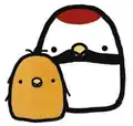
Tsurubo and Hinabo, the town's mascots
Tsurui's mascots are Tsurubo (つるぼー) and Hinabo (ひなぼー). They are red-crowned crane brothers. They are shaped like bogs of the Kushiro-shitsugen National Park.[4][5]
- Tsurubo is the oldest of the siblings. His tail resembles a cosmos flower.
- Hinabo is the youngest of the siblings.
References
- ↑ Rich, Motoko; Hida, Hikari; Delano, James Whitlow (2022-03-21). "These Revered Cranes Escaped Extinction. Can They Survive Without Humans?". The New York Times. ISSN 0362-4331. Retrieved 2022-03-23.
- ↑ 観測史上1~10位の値(年間を通じての値). JMA. Retrieved March 3, 2022.
- ↑ 気象庁 / 平年値(年・月ごとの値). JMA. Retrieved March 3, 2022.
- ↑ "つるぼー (北海道)". Yuru-Chara Grand Prix.
- ↑ "つるぼーのプロフィール(鶴居村)". Kawaii Hokkaido.
External links
 Media related to Tsurui, Hokkaidō at Wikimedia Commons
- Official Website (in Japanese)
This article is issued from Wikipedia. The text is licensed under Creative Commons - Attribution - Sharealike. Additional terms may apply for the media files.