Bonsmoulins | |
|---|---|
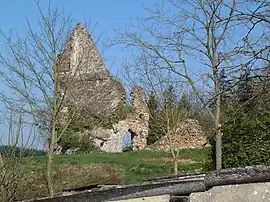 Ruins of the château | |
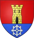 Coat of arms | |
Location of Bonsmoulins | |
 Bonsmoulins 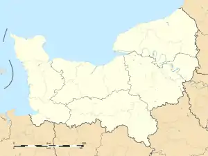 Bonsmoulins | |
| Coordinates: 48°39′04″N 0°32′12″E / 48.6511°N 0.5367°E | |
| Country | France |
| Region | Normandy |
| Department | Orne |
| Arrondissement | Mortagne-au-Perche |
| Canton | Tourouvre au Perche |
| Government | |
| • Mayor (2020–2026) | Eric Zo[1] |
| Area 1 | 7.57 km2 (2.92 sq mi) |
| Population | 232 |
| • Density | 31/km2 (79/sq mi) |
| Time zone | UTC+01:00 (CET) |
| • Summer (DST) | UTC+02:00 (CEST) |
| INSEE/Postal code | 61053 /61380 |
| Elevation | 223–291 m (732–955 ft) |
| 1 French Land Register data, which excludes lakes, ponds, glaciers > 1 km2 (0.386 sq mi or 247 acres) and river estuaries. | |
Bonsmoulins (French pronunciation: [bɔ̃mulɛ̃] ⓘ) is a commune in the Orne department in northwestern France.
Population
| Year | Pop. | ±% p.a. |
|---|---|---|
| 1968 | 204 | — |
| 1975 | 176 | −2.09% |
| 1982 | 144 | −2.83% |
| 1990 | 156 | +1.01% |
| 1999 | 213 | +3.52% |
| 2009 | 224 | +0.50% |
| 2014 | 262 | +3.18% |
| 2020 | 233 | −1.94% |
| Source: INSEE[3] | ||
Heraldry
Arms of Bonsmoulins |
The arms of Bonsmoulins are blazoned : Gules, a tower Or open, pierced and masoned sable, issuant from a base azure charged with a millwheel argent. (possibly non-official)
|
See also
References
- ↑ "Répertoire national des élus: les maires". data.gouv.fr, Plateforme ouverte des données publiques françaises (in French). 2 December 2020.
- ↑ "Populations légales 2021". The National Institute of Statistics and Economic Studies. 28 December 2023.
- ↑ Population en historique depuis 1968, INSEE
Wikimedia Commons has media related to Bonsmoulins.
This article is issued from Wikipedia. The text is licensed under Creative Commons - Attribution - Sharealike. Additional terms may apply for the media files.