Carry-le-Rouet
| |
|---|---|
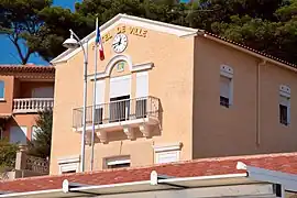
 Carry-le-Rouet Town Hall | |
.svg.png.webp) Coat of arms | |
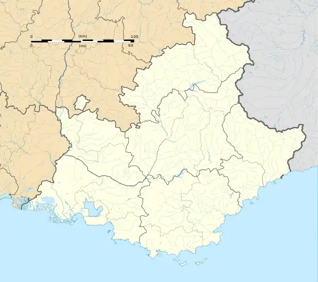
Location of Carry-le-Rouet | |
 Carry-le-Rouet  Carry-le-Rouet | |
| Coordinates: 43°19′59″N 5°09′10″E / 43.3331°N 5.1528°E | |
| Country | France |
| Region | Provence-Alpes-Côte d'Azur |
| Department | Bouches-du-Rhône |
| Arrondissement | Istres |
| Canton | Marignane |
| Intercommunality | Aix-Marseille-Provence |
| Government | |
| • Mayor (2020–2026) | René-Francis Carpentier[1] |
| Area 1 | 10 km2 (4 sq mi) |
| Population | 5,708 |
| • Density | 570/km2 (1,500/sq mi) |
| Time zone | UTC+01:00 (CET) |
| • Summer (DST) | UTC+02:00 (CEST) |
| INSEE/Postal code | 13021 /13620 |
| Elevation | 0–178 m (0–584 ft) (avg. 4 m or 13 ft) |
| 1 French Land Register data, which excludes lakes, ponds, glaciers > 1 km2 (0.386 sq mi or 247 acres) and river estuaries. | |
Carry-le-Rouet (French pronunciation: [kaʁi lə ʁwɛ]; Occitan: Carri lo Roet) or simply Carry is a commune in the Bouches-du-Rhône department in the Provence-Alpes-Côte d'Azur region in Southern France. It is a seaside resort 30 kilometres (19 mi) west of Marseille, on the Côte Bleue, reached via motorway A55 then route D5, at the foot of pine-covered hills. It is part of the Aix-Marseille-Provence Metropolis.
Every February, Les Oursinades festival takes place, celebrating the consumption of sea urchins, various shellfish and other seafood.[3]
Transport
Carry-le-Rouet is served by the Carry-le-Rouet TER PACA railway station (opened in 1915) on the Miramas–L'Estaque railway.
 TER PACA service at Carry-le-Rouet station in 2010
 Station building
Demographics
|
| ||||||||||||||||||||||||||||||||||||||||||||||||||||||||||||||||||||||||||||||||||||||||||||||||||||||||||||||||||
| Source: EHESS[4] and INSEE (1968–2020)[5] | |||||||||||||||||||||||||||||||||||||||||||||||||||||||||||||||||||||||||||||||||||||||||||||||||||||||||||||||||||
Personalities
- Comic actor Fernandel, who built his family's house above the beach in the 1930s.
- The singer Nina Simone, who lived out the last years of her life in Carry-le-Rouet and died at her home in 2003.
Sister cities
See also
References
- ↑ "Répertoire national des élus: les maires". data.gouv.fr, Plateforme ouverte des données publiques françaises (in French). 2 December 2020.
- ↑ "Populations légales 2021". The National Institute of Statistics and Economic Studies. 28 December 2023.
- ↑ "Les Oursinades festival". Carry-le-Route Office de Tourisme. Retrieved 7 August 2020.
- ↑ Des villages de Cassini aux communes d'aujourd'hui: Commune data sheet Carry-le-Rouet, EHESS (in French).
- ↑ Population en historique depuis 1968, INSEE
External links
- Official website (in French)
Wikimedia Commons has media related to Carry-le-Rouet.
This article is issued from Wikipedia. The text is licensed under Creative Commons - Attribution - Sharealike. Additional terms may apply for the media files.