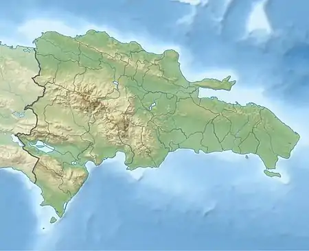
Cevicos | |
|---|---|
 Cevicos Cevicos in the Dominican Republic | |
| Coordinates: 19°0′0″N 69°58′48″W / 19.00000°N 69.98000°W | |
| Country | |
| Province | Sánchez Ramírez |
| Area | |
| • Total | 305.64 km2 (118.01 sq mi) |
| Population (2012)[2] | |
| • Total | 12,589 |
| • Density | 41/km2 (110/sq mi) |
| • Urban | 4,285 |
| Municipal Districts | 2 (La Cueva, Platanal) |
Cevicos is a town and municipality in the Sánchez Ramírez province of the Dominican Republic. Municipal population, as of 2012, is of 12,589. Town's proper population is of 4,285.[2]
Overview
The town is located in a green plateau between Cotuí and Sabana Grande de Boyá. It municipal district (or hamlet) is the village of La Cueva.
Cevicos produces fruits like mango, pineapple, sugar cane, passion fruit and many others.
Climate
| Climate data for Cevicos (1961–1990) | |||||||||||||
|---|---|---|---|---|---|---|---|---|---|---|---|---|---|
| Month | Jan | Feb | Mar | Apr | May | Jun | Jul | Aug | Sep | Oct | Nov | Dec | Year |
| Record high °C (°F) | 35.5 (95.9) |
35.0 (95.0) |
36.0 (96.8) |
37.5 (99.5) |
38.0 (100.4) |
37.5 (99.5) |
36.0 (96.8) |
38.0 (100.4) |
39.0 (102.2) |
38.0 (100.4) |
35.0 (95.0) |
34.0 (93.2) |
39.0 (102.2) |
| Mean daily maximum °C (°F) | 28.2 (82.8) |
29.2 (84.6) |
30.4 (86.7) |
31.1 (88.0) |
31.4 (88.5) |
32.0 (89.6) |
31.9 (89.4) |
32.0 (89.6) |
32.1 (89.8) |
31.5 (88.7) |
29.7 (85.5) |
28.2 (82.8) |
30.6 (87.1) |
| Mean daily minimum °C (°F) | 17.5 (63.5) |
17.6 (63.7) |
18.1 (64.6) |
19.1 (66.4) |
20.3 (68.5) |
20.9 (69.6) |
21.1 (70.0) |
21.0 (69.8) |
20.8 (69.4) |
20.6 (69.1) |
19.7 (67.5) |
18.3 (64.9) |
19.6 (67.3) |
| Record low °C (°F) | 10.0 (50.0) |
12.0 (53.6) |
12.0 (53.6) |
11.8 (53.2) |
14.5 (58.1) |
16.5 (61.7) |
16.2 (61.2) |
17.0 (62.6) |
18.0 (64.4) |
17.0 (62.6) |
12.2 (54.0) |
12.0 (53.6) |
10.0 (50.0) |
| Average rainfall mm (inches) | 80.0 (3.15) |
84.0 (3.31) |
108.1 (4.26) |
145.9 (5.74) |
271.4 (10.69) |
265.4 (10.45) |
240.8 (9.48) |
288.5 (11.36) |
205.7 (8.10) |
200.6 (7.90) |
149.6 (5.89) |
117.8 (4.64) |
2,157.8 (84.95) |
| Average rainy days (≥ 1.0 mm) | 10.8 | 9.1 | 10.0 | 9.4 | 15.6 | 16.3 | 17.5 | 18.6 | 14.6 | 14.4 | 13.4 | 12.5 | 162.2 |
| Source: NOAA[3] | |||||||||||||
References
- ↑ Superficies a nivel de municipios, Oficina Nacional de Estadistica Archived April 17, 2009, at the Wayback Machine
- 1 2 Censo 2012 de Población y Vivienda, Oficina Nacional de Estadistica
- ↑ "Cevicos Climate Normals 1961-1990". National Oceanic and Atmospheric Administration. Retrieved September 11, 2016.
This article is issued from Wikipedia. The text is licensed under Creative Commons - Attribution - Sharealike. Additional terms may apply for the media files.