Changureh
چنگوره | |
|---|---|
village | |
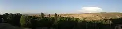 village view. | |
 Changureh | |
| Coordinates: 35°46′08″N 48°57′45″E / 35.76889°N 48.96250°E | |
| Country | |
| Province | Qazvin |
| County | Avaj |
| Bakhsh | Central |
| Rural District | Hesar-e Valiyeasr |
| Population (2006) | |
| • Total | 54 |
| Time zone | UTC+3:30 (IRST) |
Changureh (Persian: چنگوره, also Romanized as Changūreh and Changūrah; also known as Jānkūra and Changooreh Kharaghan Gharbi)[1] is a village in Hesar-e Valiyeasr Rural District, Central District, Avaj County, Qazvin Province, Iran. At the 2006 census, its population was 54, in 18 families.[2]
Changureh suffered severely in the 2002 Bou'in-Zahra earthquake, the epicenter of which was located near the village.
References
- ↑ Changureh can be found at GEOnet Names Server, at this link, by opening the Advanced Search box, entering "-3058050" in the "Unique Feature Id" form, and clicking on "Search Database".
- ↑ "Census of the Islamic Republic of Iran, 1385 (2006)" (Excel). Statistical Center of Iran. Archived from the original on 2011-09-20.
| Capital | |||||||||||||||||||||||
|---|---|---|---|---|---|---|---|---|---|---|---|---|---|---|---|---|---|---|---|---|---|---|---|
| Districts |
| ||||||||||||||||||||||
This article is issued from Wikipedia. The text is licensed under Creative Commons - Attribution - Sharealike. Additional terms may apply for the media files.