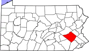
Colony Park, Pennsylvania | |
|---|---|
 Colony Park | |
| Coordinates: 40°20′49″N 75°58′57″W / 40.34694°N 75.98250°W | |
| Country | United States |
| State | Pennsylvania |
| County | Berks |
| Township | Spring |
| Area | |
| • Total | 0.38 sq mi (0.97 km2) |
| • Land | 0.38 sq mi (0.97 km2) |
| • Water | 0.00 sq mi (0.00 km2) |
| Elevation | 344 ft (105 m) |
| Population | |
| • Total | 1,269 |
| • Density | 3,375.00/sq mi (1,302.14/km2) |
| Time zone | UTC-5 (Eastern (EST)) |
| • Summer (DST) | UTC-4 (EDT) |
| ZIP code | 19610[4] |
| Area code(s) | 484, 610 and 835 |
| FIPS code | 42-15368 |
| GNIS feature ID | 2633342 |
Colony Park is a census-designated place[5] in Spring Township, Berks County, Pennsylvania, United States. It is located just off U.S. 222, approximately one mile northwest of the borough of Wyomissing. As of the 2010 census, the population was 1,076 residents.[6]
| Census | Pop. | Note | %± |
|---|---|---|---|
| 2020 | 1,269 | — | |
| U.S. Decennial Census[7][3] | |||
References
- ↑ "ArcGIS REST Services Directory". United States Census Bureau. Retrieved October 12, 2022.
- ↑ "Colony Park Census Designated Place". Geographic Names Information System. United States Geological Survey, United States Department of the Interior. Retrieved February 28, 2013.
- 1 2 "Census Population API". United States Census Bureau. Retrieved October 12, 2022.
- ↑ "Colony Park PA ZIP Code". zipdatamaps.com. 2023. Retrieved June 27, 2023.
- ↑ "2010 U.S. Census website". United States Census Bureau. Retrieved December 29, 2015.
- ↑ "U.S. Census website". United States Census Bureau. Retrieved May 14, 2011.
- ↑ "Census of Population and Housing". Census.gov. Retrieved June 4, 2016.
This article is issued from Wikipedia. The text is licensed under Creative Commons - Attribution - Sharealike. Additional terms may apply for the media files.
