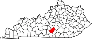
Crocus | |
|---|---|
 Crocus Location within the state of Kentucky  Crocus Crocus (the United States) | |
| Coordinates: 36°58′50″N 85°12′39″W / 36.98056°N 85.21083°W | |
| Country | United States |
| State | Kentucky |
| County | Adair and Russell |
| Elevation | 988 ft (301 m) |
| Time zone | UTC-6 (Central (CST)) |
| • Summer (DST) | UTC-5 (CDT) |
| GNIS feature ID | 507785 |
Crocus is an unincorporated community in Adair and Russell counties in the U.S. state of Kentucky. Its elevation is 988 feet (301 m).[1]
The community, first established in 1840, possibly received its name from the wild crocuses growing along the nearby creek.[2]
References
- ↑ U.S. Geological Survey Geographic Names Information System: Crocus, Kentucky
- ↑ Rennick, Robert M. (1987). Kentucky Place Names. University Press of Kentucky. p. 73. ISBN 0813126312. Retrieved April 28, 2013.
This article is issued from Wikipedia. The text is licensed under Creative Commons - Attribution - Sharealike. Additional terms may apply for the media files.

