Dippach
Dippech | |
|---|---|
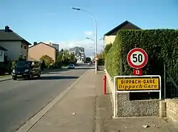 Dippach-Gare | |
 Coat of arms | |
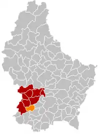 Map of Luxembourg with Dippach highlighted in orange, and the canton in dark red | |
| Coordinates: 49°35′15″N 5°59′00″E / 49.5875°N 5.9833°E | |
| Country | |
| Canton | Capellen |
| Area | |
| • Total | 17.42 km2 (6.73 sq mi) |
| • Rank | 66th of 102 |
| Highest elevation | 352 m (1,155 ft) |
| • Rank | 84th of 102 |
| Lowest elevation | 277 m (909 ft) |
| • Rank | 79th of 102 |
| Population (2023) | |
| • Total | 4,635 |
| • Rank | 38th of 102 |
| • Density | 270/km2 (690/sq mi) |
| • Rank | 32nd of 102 |
| Time zone | UTC+1 (CET) |
| • Summer (DST) | UTC+2 (CEST) |
| LAU 2 | LU0000101 |
| Website | dippach.lu |
Dippach (Luxembourgish: Dippech [ˈdipəɕ] ⓘ) is a commune and small town in south-western Luxembourg. It is part of the canton of Capellen, which is part of the district of Luxembourg. The commune's administrative centre is Schouweiler. The River Mess, a tributary of the Alzette, rises here.
As of 2005, the town of Dippach, which lies in the north-east of the commune, has a population of 790. Other villages within the commune include Bettange-sur-Mess, Schouweiler, and Sprinkange.
Population
Notable people
- Johann Peter Kirsch (1861–1941), ecclesiastical historian and biblical archaeologist
- Laurent Didier (born 1984), former road bicycle racer
- Tom Wirtgen (born 1996), cyclist
Twin towns — sister cities
 Landiras, France
Aerial views
 Aerial view of the localities of Dippach (Dippech)...
 ... and of Bettange-sur-Mess (Betten op der Mess) and Dippach-Gare (Dippech-Gare).
References
- ↑ "Population par canton et commune". statistiques.public.lu. Archived from the original on 2016-09-12. Retrieved 11 January 2022.
- ↑ "Présentation". dippach.lu (in French). Dippach. Retrieved 2019-09-05.
External links
 Media related to Dippach (Luxembourg) at Wikimedia Commons

This article is issued from Wikipedia. The text is licensed under Creative Commons - Attribution - Sharealike. Additional terms may apply for the media files.