Dolní Loučky | |
|---|---|
.jpg.webp) Aerial view | |
 Flag  Coat of arms | |
 Dolní Loučky Location in the Czech Republic | |
| Coordinates: 49°11′30″N 16°46′17″E / 49.19167°N 16.77139°E | |
| Country | |
| Region | South Moravian |
| District | Brno-Country |
| First mentioned | 1236 |
| Area | |
| • Total | 8.14 km2 (3.14 sq mi) |
| Elevation | 283 m (928 ft) |
| Population (2023-01-01)[1] | |
| • Total | 1,318 |
| • Density | 160/km2 (420/sq mi) |
| Time zone | UTC+1 (CET) |
| • Summer (DST) | UTC+2 (CEST) |
| Postal code | 594 55 |
| Website | www |
Dolní Loučky is a municipality and village in Brno-Country District in the South Moravian Region of the Czech Republic. It has about 1,300 inhabitants.
Dolní Loučky lies approximately 26 kilometres (16 mi) north-west of Brno and 162 km (101 mi) south-east of Prague.
Administrative parts
The village of Střemchoví is an administrative part of Dolní Loučky.
| Year | Pop. | ±% |
|---|---|---|
| 1869 | 782 | — |
| 1880 | 841 | +7.5% |
| 1890 | 866 | +3.0% |
| 1900 | 882 | +1.8% |
| 1910 | 861 | −2.4% |
| 1921 | 845 | −1.9% |
| 1930 | 926 | +9.6% |
| 1950 | 1,092 | +17.9% |
| 1961 | 984 | −9.9% |
| 1970 | 1,011 | +2.7% |
| 1980 | 1,087 | +7.5% |
| 1991 | 1,056 | −2.9% |
| 2001 | 1,102 | +4.4% |
| 2011 | 1,204 | +9.3% |
| 2021 | 1,276 | +6.0% |
| Source: Censuses[2][3] | ||
Notable people
- Antonín Mrkos (1918–1996), astronomer
Gallery
 Orlovna (the gymnasium)
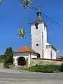 Church of Saint Martin
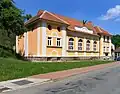
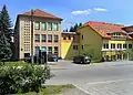 Old and new school
References
- ↑ "Population of Municipalities – 1 January 2023". Czech Statistical Office. 2023-05-23.
- ↑ "Historický lexikon obcí České republiky 1869–2011 – Okres Brno-venkov" (in Czech). Czech Statistical Office. 2015-12-21.
- ↑ "Population Census 2021: Population by sex". Public Database. Czech Statistical Office. 2021-03-27.
Wikimedia Commons has media related to Dolní Loučky.
This article is issued from Wikipedia. The text is licensed under Creative Commons - Attribution - Sharealike. Additional terms may apply for the media files.