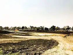
Dondapadu | |
|---|---|
 Dondapadu village | |
.svg.png.webp) Dondapadu Location in Andhra Pradesh, India | |
| Coordinates: 16°27′32″N 81°02′07″E / 16.4589°N 81.0354°E | |
| Country | India |
| State | Andhra Pradesh |
| District | Guntur |
| Area | |
| • Total | 3.91 km2 (1.51 sq mi) |
| Population (2011)[1] | |
| • Total | 2,664 |
| • Density | 680/km2 (1,800/sq mi) |
| Languages | |
| • Official | Telugu |
| Time zone | UTC+5:30 (IST) |
| PIN | 522 237 |
| Vehicle registration | AP |
Dondapadu is a neighbourhood and a part of Urban Notified Area of Amaravati, the state capital of the Indian state of Andhra Pradesh.[2] It was a village in Thullur mandal of Guntur district, prior to its denotification as gram panchayat.[1][3] It has a beautiful temple dedicated to lord Ganesh (the son of Parvati and Shiva) built by Sri Nannapaneni Surya Prakash Rao garu and Pushpavathi garu in the year 2007.
Transport
Dondapadu lies on north east of Gudivada town. Although there are no bus services available, frequent auto service is available. This village is approximately 6.5 km from Gudivada which is the nearest census town.
References
- 1 2 3 "District Census Handbook - Krishna" (PDF). Census of India. p. 16,376. Retrieved 5 February 2016.
- ↑ "New Andhra capital Amaravati to compete for Smart City tag". The New Indian Express. 25 May 2016. Retrieved 6 June 2016.
- ↑ "Declaration of A.P. Capital City Area–Revised orders" (PDF). Andhra Nation. Municipal Administration and Urban Development Department. 22 September 2015. Archived from the original (PDF) on 24 June 2016. Retrieved 21 February 2016.
This article is issued from Wikipedia. The text is licensed under Creative Commons - Attribution - Sharealike. Additional terms may apply for the media files.