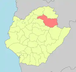
23°17′0.2″N 120°26′35.6″E / 23.283389°N 120.443222°E
Dongshan
東山區 | |
|---|---|
| Dongshan District | |
 Mount Kantou in Dongshan District | |
| Nickname: Hoansia | |
 Dongshan District in Tainan City | |
| Country | Taiwan |
| Special municipality | Tainan |
| Area | |
| • Total | 124.978 km2 (48.254 sq mi) |
| Population (May 2022) | |
| • Total | 19,560 |
| • Density | 190.273/km2 (492.80/sq mi) |
| Time zone | UTC+8 (CST) |
| Postal code | 733 |
| Website | dongshan |

Dongshan District (Chinese: 東山區; pinyin: Dōngshān Qū; Wade–Giles: Tung1-shan1 Ch'ü1; Pe̍h-ōe-jī: Tong-san-khu) is a rural district in Tainan, Taiwan. It was formerly called Hoansia (Chinese: 番社; Pe̍h-ōe-jī: hoan-siā).[1]
History
During the Dutch era, the place was known as Dorko, and existed as a township called To-lo-koh in the early 20th century.[2]
After the handover of Taiwan from Japan to the Republic of China in 1945, Dongshan was organized as a rural township of Tainan County. On 25 December 2010, Tainan County merged with Tainan City and Dongshan was upgraded to a district of the city.
Administrative divisions
Tungshan, Tungzhong, Tungzheng, Dake, Sanrong, Keli, Tunghe, Shengxian, Nanxi, Shuiyun, Linan, Tungyuan, Lingnan, Nanshi, Jingshan and Gaoyuan Village.
Economy
Dongshan is famous for its coffee crop.
Tourist attractions
- Dongshan Bisuan Temple
- Dongshan Sports Park
- Senwho Holiday Farm
- Shueiyun Village
- Sikou Little Switzerland
- Siraya National Scenic Area
Notable natives
- Su Yu-chang, martial artist, scholar and practitioner of traditional Chinese medicine
References
- ↑ "Dongshan Township". Archived from the original on 2014-02-21. Retrieved 2014-02-08.
- ↑ Campbell, William (1903). "Explanatory Notes". Formosa under the Dutch: described from contemporary records, with explanatory notes and a bibliography of the island. London: Kegan Paul. p. 541. OCLC 644323041.