23°29′20″N 120°28′36″E / 23.488911°N 120.476562°E
East District
東區 | |
|---|---|
 Chiayi City Hall | |
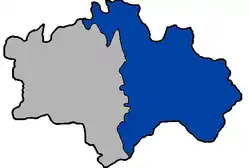
 East District in Chiayi City | |
| Location | Chiayi City, Taiwan |
| Urban villages (里) | 39[1] |
| Government | |
| • Leader (區長) | Sun Shifu (孫世福) |
| Area | |
| • Total | 29.1195 km2 (11.2431 sq mi) |
| Population (September 2019)[2] | |
| • Total | 120,598 |
| • Density | 4,100/km2 (11,000/sq mi) |
| Time zone | UTC+8 (National Standard Time) |
| Postal code | 600 |
| Website | east |
East District (Chinese: 東區; pinyin: Dōng Qū; Pe̍h-ōe-jī: Tang-khu) is a district in east Chiayi City, Taiwan. The district is the city seat of Chiayi City.
History

Map of the region including the area of today's East District, Chiayi (1950)

Map of the city including the area of today's East District, Chiayi (1950s)

Chiayi City in 1946-1950
The East District was established on 6 October 1990.[3]
Administrative divisions
East District consists of the following villages:[4][5]
- (公園聯合里)
- Duanzhu (短竹里), Lantan (蘭潭里), Dongchuan (東川里), Luliao (鹿寮里), Lucuo (盧厝里), Wenya (文雅里), Wangtian (王田里), Changzhu (長竹里), Houzhuang (後庄里), Xindian (新店里), Zuntou (圳頭里)
- (東南門聯合里)
- Zhongshan (中山里), Taiping (太平里), Dongxing (東興里), Huanan (華南里), Zhongyang (中央里), Zhaoyang (朝陽里), Minzu (民族里), Guogou (過溝里)
- (新南聯合里)
- Xinkai (新開里), Xuanxin (宣信里), Xingnan (興南里), Fengnian (豐年里), Fangcao (芳草里), Fang'an (芳安里), Dingliao (頂寮里), Anliao (安寮里), Anye (安業里), Xingcun (興村里), Xing'an (興安里), Xingren (興仁里)
- (北門聯合里)
- Beimen (北門里), Linsen (林森里), Zhongzhuang (中庄里), Dingzhuang (頂庄里), Yijiao (義教里), Renyi (仁義里), Houhu (後湖里) and Laoteng (荖藤里).
Government institutions
Education
- National Chiayi University - Lantan Main Campus and Linsen Campus
- Tatung Institute of Commerce and Technology
- Chung Jen College of Nursing, Health Science and Management
Tourist attractions
Transportation
See also
References
- 1 2 沿革簡介. 嘉義市東區區公所 East District Office, Chiayi City (in Chinese (Taiwan)). 5 March 2018. Retrieved 17 October 2019.
轄區土地面積有29.1195平方公里,分設39里,654鄰。
- ↑ 村里鄰人口數. 嘉義市東區戶政事務所 East District Household Registration Office, Chiayi City (in Chinese (Taiwan)). Retrieved 17 October 2019.
- ↑ "East District Office, Chiayi City - History". Archived from the original on 2017-03-14. Retrieved 2016-01-06.
- ↑ "Location and Area". East District Office, Chiayi City. 3 December 2016. Retrieved 17 October 2019.
The area of East District is 29.1195 39 [sic] km² with 39 Villages and 640 Neighborhoods.
- ↑ 聯合里辦公處. 嘉義市東區區公所 East District Office, Chiayi City. 3 December 2016. Retrieved 17 October 2019.(includes maps)
Wikimedia Commons has media related to East District, Chiayi City.
This article is issued from Wikipedia. The text is licensed under Creative Commons - Attribution - Sharealike. Additional terms may apply for the media files.