| Schubert South Australia—House of Assembly | |||||||||||||||
|---|---|---|---|---|---|---|---|---|---|---|---|---|---|---|---|
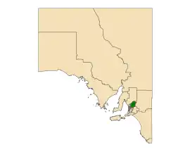 Electoral district of Schubert (green) in South Australia | |||||||||||||||
| State | South Australia | ||||||||||||||
| Created | 1997 | ||||||||||||||
| MP | Ashton Hurn | ||||||||||||||
| Party | Liberal Party of Australia | ||||||||||||||
| Namesake | Max Schubert | ||||||||||||||
| Electors | 25,727 (2018) | ||||||||||||||
| Area | 2,017.8 km2 (779.1 sq mi) | ||||||||||||||
| Demographic | Rural | ||||||||||||||
| Coordinates | 34°40′48″S 139°11′32″E / 34.68000°S 139.19222°E | ||||||||||||||
| |||||||||||||||
| Footnotes | |||||||||||||||
| Electoral District map[3] | |||||||||||||||
Schubert is a single-member electoral district for the South Australian House of Assembly covering an area of 2,017.8 km2. It is named after Max Schubert, the winemaker of Penfolds Grange Hermitage. The Barossa Valley area was first represented by the seat of Barossa. The seat of Custance was abolished and recreated as Schubert in the 1994 redistribution and first contested at the 1997 election. Schubert currently covers the Barossa Valley area, the northern parts of the Adelaide Hills and much of the inner north and northwest plains bordering Adelaide. Areas covered include Eden Valley, Kangaroo Flat, Nuriootpa, Lyndoch, Springton, Tanunda, Wasleys and Williamstown.
Members for Schubert
| Member | Party | Term | |
|---|---|---|---|
| Ivan Venning | Liberal | 1997–2014 | |
| Stephan Knoll | Liberal | 2014–2022 | |
| Ashton Hurn | Liberal | 2022–present | |
Election results
| Party | Candidate | Votes | % | ±% | |
|---|---|---|---|---|---|
| Liberal | Ashton Hurn | 12,580 | 51.4 | +2.1 | |
| Labor | Connor Watson | 5,557 | 22.7 | +1.9 | |
| Greens | Beverley Morris | 2,493 | 10.2 | +4.8 | |
| One Nation | Phill Mueller | 1,658 | 6.8 | +6.8 | |
| Family First | Alfred Gerhard | 934 | 3.8 | +3.8 | |
| Independent | Lea Rebane | 707 | 2.9 | +2.9 | |
| National | Bruce Preece | 522 | 2.1 | +2.1 | |
| Total formal votes | 24,451 | 96.2 | |||
| Informal votes | 960 | 3.8 | |||
| Turnout | 25,411 | 92.7 | |||
| Two-party-preferred result | |||||
| Liberal | Ashton Hurn | 15,124 | 61.9 | −3.8 | |
| Labor | Connor Watson | 9,327 | 38.1 | +3.8 | |
| Liberal hold | Swing | −3.8 | |||
Notes
- ↑ Taylor & 4 others
- ↑ Taylor & 4 others & Hammond
- ↑ Electoral District of Schubert (Map). Electoral Commission of South Australia. 2018. Retrieved 1 April 2018.
References
This article is issued from Wikipedia. The text is licensed under Creative Commons - Attribution - Sharealike. Additional terms may apply for the media files.