Garhi Sanjar Khan | |
|---|---|
Village | |
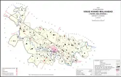 Map showing Garhi Sanjar Khan (#109) in Malihabad CD block | |
| Country | |
| State | Uttar Pradesh |
| District | Lucknow |
| Area | |
| • Total | 1.046 km2 (0.404 sq mi) |
| Population (2011)[1] | |
| • Total | 2,833 |
| • Density | 2,700/km2 (7,000/sq mi) |
| Languages | |
| • Official | Hindi |
| Time zone | UTC+5:30 (IST) |
Garhi Sanjar Khan is a village in Malihabad block of Lucknow district, Uttar Pradesh, India.[1] It is located immediately to the west of Malihabad, and it is surrounded by the Behta river on three sides.[2] Markets are held here twice per week.[2] The main staple foods are wheat and rice.[3] As of 2011, Garhi Sanjar Khan has a population of 2,833 people, in 520 households.[1]
History
Originally called Bulakinagar, Garhi Sanjar Khan was the first site that the Amanzai Pathans came to in the region.[2] Their ancestor, Diwan Muhammad Khan, was originally from Banair, near Peshawar, and had been invited to Hindustan by Darya Khan Lodi.[2] Diwan Muhammad Khan's sons, Kawal Khan and Bahadur Khan, were then followers of Darya Khan's sons, Diler Khan (governor of Awadh) and Bahadur Khan (governor of Kabul).[2] The brothers Kawal and Bahadur came to Bulakinagar in 1656; Bahadur's son Sarmast Khan later left and settled in nearby Bakhtiyarnagar, while Kawal Khan's son Sanjar Khan remained in Bulakinagar and gave the village its present name of Garhi Sanjar Khan.[2] Sanjar Khan's descendants remained the zamindars of the village into the 20th century.[2] The last of these great zamindars, Arshad Ullah Khan passed away 9 May 1988 in his ancestral mansion "Amjad Mahal".
The 1961 census recorded Garhi Sanjar Khan as comprising 3 hamlets, with a total population of 1,340 (706 male and 634 female), in 267 households and 226 physical houses.[4] The area of the village was given as 259 acres.[4]
The 1981 census recorded Garhi Sanjar Khan as having a population of 1,951 people, in 331 households, and covering an area of 104.82 hectares.[3]
References
- 1 2 3 4 "Census of India 2011: Uttar Pradesh District Census Handbook - Lucknow, Part A (Village and Town Directory)". Census 2011 India. pp. 94–111. Retrieved 20 July 2021.
- 1 2 3 4 5 6 7 Nevill, H.R. (1904). Lucknow - A Gazetteer. Allahabad: Government Press. p. 183. Retrieved 20 July 2021.
- 1 2 Census 1981 Uttar Pradesh: District Census Handbook Part XIII-A: Village & Town Directory, District Lucknow. 1982. pp. 32–3. Retrieved 20 July 2021.
- 1 2 Census 1961: District Census Handbook, Uttar Pradesh (38 - Lucknow District) (PDF). Lucknow. 1965. pp. x-xi of section "Malihabad Tahsil". Retrieved 20 July 2021.
{{cite book}}: CS1 maint: location missing publisher (link)