Harchandpur | |
|---|---|
Village | |
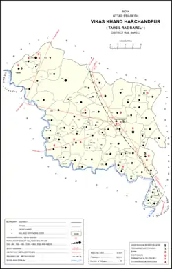 Map of Harchandpur CD block | |
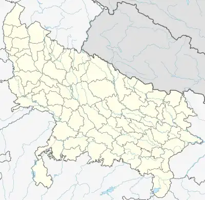 Harchandpur Location in Uttar Pradesh, India | |
| Coordinates: 26°22′N 81°10′E / 26.36°N 81.17°E | |
| Country | |
| State | Uttar Pradesh |
| District | Raebareli |
| Government | |
| • Type | Legislative Assembly |
| • Body | Government of Uttar Pradesh |
| • MLA | Rakesh Singh (INC) |
| Population (2016) | |
| • Total | 140,274 |
| Time zone | UTC+5:30 (IST) |
| PIN | 229303 |
| Telephone Code | +91-535 |
| Vehicle registration | UP-33 |
| Official language | Hindi |
| Website | raebareli |
Harchandpur is a village and corresponding community development block in Raebareli district, Uttar Pradesh, India.[1] It is located on the Baiti river, which is a tributary of the Sai, and it is northeast from the district headquarters on the road to Lucknow.[2] Particularly since the coming of the railway in the 1800s, Harchandpur serves as one of the main commercial centres for the surrounding region; it is also a major exporter of local goods.[2] As of 2011, its population is 4,348 people, in 833 households.[1]
Harchandpur is also a constituency of the Uttar Pradesh Legislative Assembly, under the district of Raebareli.[3] The Pin Code of the town is 229303 and there are 47 Gram panchayats under Harchandpur.[4]
History
Harchand was founded by Nabh Rai, a Kayastha who served as the diwan to the Bais raja Tilok Chand, and named after his son Har Chand, who was adopted in 1350 Samvat.[2] His descendants are still major landowners in Harchandpur; one of them, Jai Narain Srivastava, was appointed the first Station Master of Harchandpur Railway Station in 1893.
With the opening of the Oudh and Rohilkhand Railway in the 1800s, Harchandpur experienced a boom in commercial activity.[2] The main line of the railway passed through town, and the Harchandpur railway station quickly became a major point of export for local goods like grain, hides, and oilseeds.[2] The Raghubarganj bazar in Harchandpur was founded by Thakurain Udairaj Kunwar in 1894 (after the opening of the station) and named after her late husband Raghubar Bakhsh Singh, the taluqdar of Hasnapur.[2] By 1905, it was described as one of the main markets in the Raebareli tehsil.[2] At that point, it also had a post office, a cattle pound, and a large primary school, as well as a military encampment on the road to the northwest.[2] The population in 1901 was 1,457, including many Brahmins and Banias.[2]
Transport
Road
Harchandpur is on the route of National Highway 30, between Lucknow and Rae Bareli. [5]
Bus
Uttar Pradesh State Road Transport Corporation (UPSRTC) buses also run through the town. Buses stop near the main market place. Private transport vehicles runs all directions to near locations.
Rail
The town has its own railway station. The rail line connects Rae Bareli to Lucknow, on the Northern Railways network.[6]
Air
- Lucknow International Airport towards west (approx. 64 km)
- Raebareli Airport toward east (approx. 30 km)
National Highway
National Highway 30 (India) NH 30 - Lucknow 》 Raebareli 》 Allahabad
Education
Harchandpur has quality educational institutions affiliated to Central Board of Secondary Education, Uttar Pradesh Board, and CSJM University Kanpur. For primary education, nearly every village has a government school and a number of new private institutions have also footholded in recent past.
Colleges
- Janpad Inter College, Harchandpur Raebareli.
- Vishvanath Siksha Sansthan, Achleshwar.
- Sun Shine Public School, Maharajganj Road, Harchandpur.
- Bal Vidya Mandir Inter College, Gangaganj.
- Dayawati Modi Public School, Harchandpur.
- P.D. Public School, Achleshwar.
- Chandrapal Inter College, Gangaganj.
- Sri Mahavir Singh Smarak Mahavidyalaya, Kathwara Harchandpur.
- Mahavir Institute Of Technology & Management (MITM), Harchandpur.
- Mahavir Institute Of Pharmacy, Kathwara Harchandpur.
- Vishvanath Singh Smarak Degree College, Rahwan.
- ABS Public School, Railway station Road Harchandpur
- BLPS Public School, Pili Kothi, Harchandpur
Temples
- Aastik Baba Temple, Lalupur
- Achleshwar Dham, Achleshwar Market (Rahwan)
- Maa Hulka Mandir, Baragadaha
- Sevareshwar Temple, Seonthi
- Shani Temple, Harchandpur
- Hanuman mandir
Villages
Harchandpur CD block has the following 80 villages:[1]
| Village name | Total land area (hectares) | Population (in 2011) |
|---|---|---|
| Tera Baraula | 599.2 | 3,264 |
| Ufarapur | 158 | 1,494 |
| Pasi Tusi | 91.5 | 645 |
| Pashchhim Gaon | 811.6 | 5,644 |
| Madan Tusi | 270.5 | 995 |
| Nanda Khera | 139.7 | 1,777 |
| Aghaura | 457 | 1,836 |
| Sarai Umar | 464 | 2,434 |
| Johwa Sharki | 1,934.9 | 10,657 |
| Johwahisar | 229.3 | 1,692 |
| Kamkeypur | 133.1 | 805 |
| Datauli | 423.8 | 1,980 |
| Seri | 283.7 | 1,948 |
| Piyarepur | 383.4 | 2,434 |
| Kanhat | 114.7 | 596 |
| Bala | 710.1 | 4,123 |
| Shobhapur | 195.4 | 1,281 |
| Malikpur Barna | 156.6 | 901 |
| Majhigavan Hardoi | 221.4 | 1,259 |
| Salimpur Khas | 291.5 | 1,701 |
| Gunawar Kamegarpur | 350.2 | 2,080 |
| Pindori Sargahi | 269.4 | 1,448 |
| Kashau Khas | 352.6 | 2,640 |
| Paharpur Kasho | 289.6 | 1,136 |
| Kamalpur | 132.5 | 760 |
| Hidain | 438.8 | 3,092 |
| Kandaura | 383.2 | 4,494 |
| Teri Maniya Teekar | 285.5 | 1,406 |
| Harchandpur (block headquarters) | 264.2 | 4,348 |
| Hataiya | 188.3 | 1,287 |
| Kathwara | 513.4 | 5,115 |
| Mahmadmau | 80.9 | 567 |
| Didhaura Som Mau | 553 | 4,019 |
| Pandepur | 326.2 | 1,738 |
| Seonthi | 435.1 | 3,075 |
| Mohammadpur Dighaura | 182.1 | 1,020 |
| Itkuti | 158.1 | 568 |
| Lakhanapur | 96.8 | 564 |
| Ruknapur | 119.1 | 1,139 |
| Tengana | 130.4 | 401 |
| Khirijpur Karaundi | 195.2 | 1,610 |
| Ambahar | 43.6 | 192 |
| Bargadha | 153.5 | 847 |
| Hilalganj | 246.8 | 1,114 |
| Sohaliya | 396.5 | 1,956 |
| Sirsa | 364 | 829 |
| Antari | 105.7 | 2 |
| Para | 214.7 | 2,142 |
| Chak Sunda | 111.5 | 1,223 |
| Rahwan | 588.3 | 4,292 |
| Ghunsari | 78.3 | 321 |
| Hasanapur | 89.2 | 674 |
| Baldupur | 85.4 | 607 |
| Anguri | 340.9 | 1,359 |
| Harni | 64.7 | 759 |
| Kankhara | 148 | 808 |
| Faridpur | 102.5 | 993 |
| Mawaeya | 99.6 | 553 |
| Pandera | 462 | 3,034 |
| Kotiyamau | 148.6 | 574 |
| Guloopur | 495.4 | 3,421 |
| Ajmatulla Ganj | 350.2 | 2,687 |
| Chauhaniya | 225.3 | 1,256 |
| Arivar | 207 | 1,596 |
| Alipur Khalsa | 70 | 570 |
| Usmanpur | 58.9 | 421 |
| Majhigavan Karan | 181.2 | 1,098 |
| Khuchuma | 90 | 521 |
| Shora | 408 | 3,935 |
| Majhi Gavan Rao | 215 | 1,699 |
| Dhondhari | 106 | 680 |
| Laloopur Khas | 174.5 | 1,126 |
| Mubarakpur | 246.6 | 1,326 |
| Tanda | 200.4 | 1,559 |
| Daudpur | 141 | 1,175 |
| Paltu Tanda | 81 | 414 |
| Chhivla Mau | 133 | 1,185 |
| Chak Shekhoopur | 9 | 14 |
| Lohanipur | 111 | 2,378 |
| Maidanpur | 70 | 961 |
References
- 1 2 3 "Census of India 2011: Uttar Pradesh District Census Handbook - Rae Bareli, Part A (Village and Town Directory)" (PDF). Census 2011 India. pp. 168–84. Retrieved 1 August 2021.
- 1 2 3 4 5 6 7 8 9 Nevill, H.R. (1905). Rai Bareli: A Gazetteer, Being Volume XXXIX Of The District Gazetteers Of The United Provinces Of Agra And Oudh. Allahabad: Government Press. p. 175. Retrieved 1 August 2021.
- ↑ "List of Constituencies : RAE BARELI". Myneta.info. Retrieved 2 January 2014.
- ↑ "Archived copy". Archived from the original on 13 December 2013. Retrieved 11 December 2013.
{{cite web}}: CS1 maint: archived copy as title (link) - ↑ "Rae Bareli District Map". mapsofindia.com. Retrieved 31 January 2015.
- ↑ "Sonia launches radio channel, roads, rail line in Rae Bareli". The Hindu. 2 December 2013. Retrieved 31 January 2015.