Hatné | |
|---|---|
Municipality | |
 | |
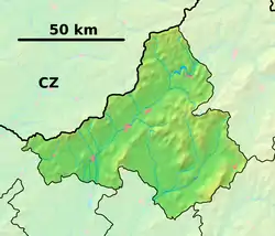 Hatné Location of Hatné in the Trenčín Region 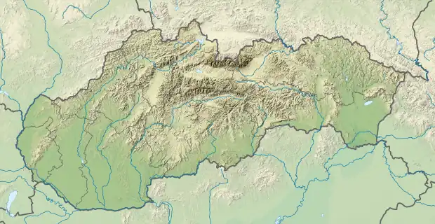 Hatné Hatné (Slovakia) | |
| Coordinates: 49°11′N 18°23′E / 49.183°N 18.383°E | |
| Country | Slovakia |
| Region | Trenčín |
| District | Považská Bystrica |
| First mentioned | 1321 |
| Area | |
| • Total | 5.43[1] km2 (2.10[1] sq mi) |
| Elevation | 313[2] m (1,027[2] ft) |
| Population (2021) | |
| • Total | 637[3] |
| Postal code | 018 02[2] |
| Area code | +421 42[2] |
| Car plate | PB |
| Website | www.hatne.sk |
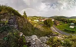
Hatné (Hungarian: Hatna) is a village and municipality in Považská Bystrica District in the Trenčín Region of north-western Slovakia.
History
In historical records the village was first mentioned in 1321.
Geography
The municipality lies at an altitude of 390 metres and covers an area of 5.435 km². It has a population of about 637 people.
Genealogical resources
The records for genealogical research are available at the state archive "Statny Archiv in Bytca, Slovakia"
- Roman Catholic church records (births/marriages/deaths): 1756-1895 (parish B)
See also
References
- 1 2 "Hustota obyvateľstva - obce [om7014rr_ukaz: Rozloha (Štvorcový meter)]". www.statistics.sk (in Slovak). Statistical Office of the Slovak Republic. 2022-03-31. Retrieved 2022-03-31.
- 1 2 3 4 "Základná charakteristika". www.statistics.sk (in Slovak). Statistical Office of the Slovak Republic. 2015-04-17. Retrieved 2022-03-31.
- ↑ "Počet obyvateľov podľa pohlavia - obce (ročne)". www.statistics.sk (in Slovak). Statistical Office of the Slovak Republic. 2022-03-31. Retrieved 2022-03-31.
External links
![]() Media related to Hatné at Wikimedia Commons
Media related to Hatné at Wikimedia Commons
- Official website

- http://www.statistics.sk/mosmis/eng/run.html Archived 2007-11-16 at the Wayback Machine
- Surnames of living people in Hatne
Municipalities of Považská Bystrica District | ||
|---|---|---|
This article is issued from Wikipedia. The text is licensed under Creative Commons - Attribution - Sharealike. Additional terms may apply for the media files.