Horní Těšice | |
|---|---|
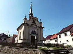 Chapel of the Virgin Mary | |
 Flag  Coat of arms | |
 Horní Těšice Location in the Czech Republic | |
| Coordinates: 49°29′44″N 17°47′10″E / 49.49556°N 17.78611°E | |
| Country | |
| Region | Olomouc |
| District | Přerov |
| First mentioned | 1141 |
| Area | |
| • Total | 3.22 km2 (1.24 sq mi) |
| Elevation | 341 m (1,119 ft) |
| Population (2023-01-01)[1] | |
| • Total | 149 |
| • Density | 46/km2 (120/sq mi) |
| Time zone | UTC+1 (CET) |
| • Summer (DST) | UTC+2 (CEST) |
| Postal code | 753 53 |
| Website | www |
Horní Těšice is a municipality and village in Přerov District in the Olomouc Region of the Czech Republic. It has about 100 inhabitants.
Horní Těšice lies approximately 25 kilometres (16 mi) east of Přerov, 40 km (25 mi) east of Olomouc, and 251 km (156 mi) east of Prague.
References
Wikimedia Commons has media related to Horní Těšice.
This article is issued from Wikipedia. The text is licensed under Creative Commons - Attribution - Sharealike. Additional terms may apply for the media files.