| Inwardleigh | |
|---|---|
 | |
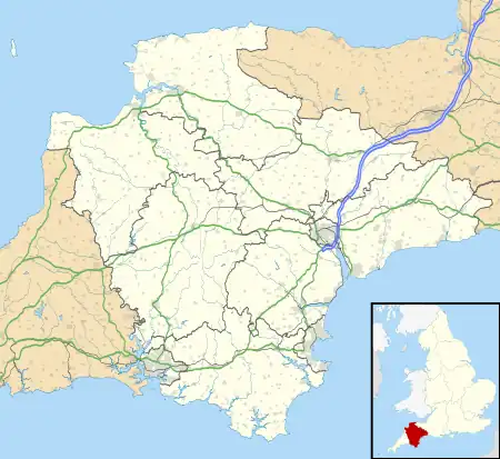
 Inwardleigh Location within Devon | |
| Area | 26.6301 km2 (10.2819 sq mi) |
| Population | 491 (2011 census) |
| • Density | 18/km2 (47/sq mi) |
| Civil parish |
|
| District | |
| Shire county | |
| Region | |
| Country | England |
| Sovereign state | United Kingdom |
| Website | http://www.inwardleigh.org.uk/index.php |
Inwardleigh is a village and civil parish about 3 and a half miles north north west of Okehampton railway station,[1] in the West Devon district, in the county of Devon, England. The parish contains the village of Folly Gate. The A386 road runs through the parish.[2] In 2011 the parish had a population of 491.[3] The parish touches Hatherleigh, Sampford Courtenay, Okehampton Hamlets, Jacobstowe and Northlew.[4]
Features
There are 17 listed buildings in Inwardleigh.[5]
History
Inwardleigh was recorded in the Domesday Book as Lege/Lega.[6] The name means 'Wood/clearing', with the "Inwar" part being a personal name.[7] It was formerly called Ingerley.[1] The parish was historically in the Black Torrington hundred.[8]
References
- 1 2 "History of Inwardleigh in West Devon". A Vision of Britain through Time. Retrieved 6 April 2019.
- ↑ "Inwardleigh Parish Council". Inwardleigh Parish Council. Retrieved 6 April 2019.
- ↑ UK Census (2011). "Local Area Report – Inwardleigh Parish (E04003356)". Nomis. Office for National Statistics. Retrieved 6 April 2019.
- ↑ "Inwardleigh". Ordnance Survey. Retrieved 6 April 2019.
- ↑ "Listed Buildings in Inwardleigh, West Devon, Devon". British Listed Buildings. Retrieved 6 April 2019.
- ↑ "Devonshire I-L". The Domesday Book Online. Retrieved 6 April 2019.
- ↑ "Inwardleigh Key to English Place-names". The University of Nottingham. Retrieved 6 April 2019.
- ↑ "The Hundreds of Devon". GENUKI. Retrieved 6 April 2019.
External links
Wikimedia Commons has media related to Inwardleigh.
This article is issued from Wikipedia. The text is licensed under Creative Commons - Attribution - Sharealike. Additional terms may apply for the media files.