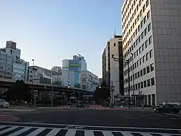
Iwamotochō (岩本町) is a district of Chiyoda, Tokyo, Japan. It consists of 3 chōme. This article also deals with Kanda-Iwamotochō (神田岩本町). As of April 1, 2007, the total population of the two districts is 1,989.
Iwamotochō is located on the northeastern part of Chiyoda. The area consisting of both Iwamotochō and Kanda-Iwamotochō borders Kanda-Sakumakaji and Kanda-Sakumachō to the north; Higashi-Kanda to the east; Nihonbashi-Kodenmachō and Nihonbashi-Honchō, Chūō to the south; and Kanda-Sudachō, Kanda-Higashimatsushitachō, Kanda-Higashikonyachō, Kanda-Konyachō, Kanda-Nishifukudachō and Kanda-Mikurachō to the west.
Showa-Dori Avenue runs between Iwamotochō and Kanda-Iwamotochō. Iwamotochō, located east to the avenue, has already undergone modernization of the addressing system while, in Kanda-Iwamotochō, located west to the avenue, the modernization has not been enforced yet. In Chiyoda, many districts in the Kanda area has the prefix Kanda-; the addressing system modernization has not been enforced in such districts.
Companies
Iwamotochō 1-chōme
Iwamotochō 2-chōme
Iwamotochō 3-chōme
Kanda-Iwamotochō
Education
Chiyoda Board of Education operates public elementary and junior high schools. Chiyoda Elementary School (千代田小学校) is the zoned elementary school for Iwamotochō 1 chōme 1-6 ban, Iwamotochō 2 chōme 1-8 ban, Iwamotochō 2 chōme 1-2 ban, and Kanda-Iwamotochō. Izumi Elementary School (和泉小学校) is the zoned elementary school for Iwamotochō 1 chōme 7-14 ban, Iwamotochō 2 chōme 9-19 ban, and Iwamotochō 3 chōme 3-11 ban.[3] There is a freedom of choice system for junior high schools in Chiyoda Ward, and so there are no specific junior high school zones.[4]
References
- ↑ "Office Location."Nippon Chemiphar. Retrieved on April 2, 2015.
- ↑ "Company Profile."Yamazaki Baking Company Limited. Retrieved on April 2, 2015.
- ↑ "区立小学校の通学区域". Chiyoda Board of Education. Retrieved 2022-10-08.
- ↑ "区立中学校の通学区域と学校選択". Chiyoda Board of Education. Retrieved 2022-10-08.
千代田区では、[...]
