C08 H07 M15 Kasumigaseki Station 霞ヶ関駅 | |||||||||||||||||||||||||||||||
|---|---|---|---|---|---|---|---|---|---|---|---|---|---|---|---|---|---|---|---|---|---|---|---|---|---|---|---|---|---|---|---|
 B1A entrance in 2021 | |||||||||||||||||||||||||||||||
| Japanese name | |||||||||||||||||||||||||||||||
| Shinjitai | 霞ケ関駅 | ||||||||||||||||||||||||||||||
| Kyūjitai | 霞ケ關驛 | ||||||||||||||||||||||||||||||
| Hiragana | かすみがせきえき | ||||||||||||||||||||||||||||||
| General information | |||||||||||||||||||||||||||||||
| Location | 2-1-2 Kasumigaseki, Chiyoda-ku, Tokyo Japan | ||||||||||||||||||||||||||||||
| Coordinates | 35°40′26″N 139°45′04″E / 35.673888°N 139.751061°E | ||||||||||||||||||||||||||||||
| Operated by | |||||||||||||||||||||||||||||||
| Line(s) | |||||||||||||||||||||||||||||||
| Platforms | 2 side platforms and 1 island platform | ||||||||||||||||||||||||||||||
| Tracks | 6 | ||||||||||||||||||||||||||||||
| Construction | |||||||||||||||||||||||||||||||
| Structure type | Underground | ||||||||||||||||||||||||||||||
| Other information | |||||||||||||||||||||||||||||||
| Station code | M15, H07, C08 | ||||||||||||||||||||||||||||||
| History | |||||||||||||||||||||||||||||||
| Opened | 15 October 1958 | ||||||||||||||||||||||||||||||
| Passengers | |||||||||||||||||||||||||||||||
| FY2019 | 151,997 daily[1] | ||||||||||||||||||||||||||||||
| Services | |||||||||||||||||||||||||||||||
| |||||||||||||||||||||||||||||||
| Location | |||||||||||||||||||||||||||||||
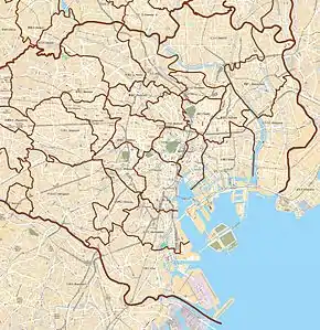
 Kasumigaseki Station Location within Special wards of Tokyo  Kasumigaseki Station Kasumigaseki Station (Tokyo Bay and Bōsō Peninsula)  Kasumigaseki Station Kasumigaseki Station (Tokyo)  Kasumigaseki Station Kasumigaseki Station (Japan) | |||||||||||||||||||||||||||||||
Kasumigaseki Station (霞ヶ関駅, Kasumigaseki-eki) is a subway station in Chiyoda, Tokyo, Japan, operated by the Tokyo subway operator Tokyo Metro. The station is located in the Kasumigaseki government district.
Lines
Kasumigaseki Station is served by the following three Tokyo Metro lines.
- M Marunouchi Line (M-15)
- H Hibiya Line (H-07)
- C Chiyoda Line (C-08)
Station layout
The platforms for Marunouchi Line serving two tracks consist of one island platform and one side platform. One side of the island platform is closed off by a fence. The platform for the Hibiya Line is an island platform serving two tracks. The platform for the Chiyoda Line is an island platform serving two tracks.
The platforms for the Chiyoda Line and the Marunouchi Line are not directly connected, and transferring passengers need to walk through the Hibiya Line platform, which takes about five minutes.
Platforms
| 1 | M Marunouchi Line | for Ogikubo, and Honancho |
| 2 | M Marunouchi Line | for Ikebukuro |
| 3 | H Hibiya Line | for Ebisu and Naka-meguro |
| 4 | H Hibiya Line | for Ginza, Ueno, and Kita-senju TS Tobu Skytree Line for Tōbu-Dōbutsu-Kōen TN Tobu Nikko Line for Minami-Kurihashi |
| 5 | C Chiyoda Line | for Meiji-jingumae and Yoyogi-uehara |
| 6 | C Chiyoda Line | for Otemachi, Kita-senju, Ayase, and Kita-ayase JL Jōban Line (Local) for Abiko and Toride |
 Marunouchi Line platforms, 2019
 Hibiya platforms, 2016
 An Odakyu 60000 series MSE Romancecar train on Metro Hakone at the Chiyoda Line platform, 2010
History
- 15 October 1958: The Marunouchi Line station opens.
- 25 March 1964: The Hibiya Line station opens.
- 20 March 1971: The Chiyoda Line station opens.
- 15 March 1995: Aum Shinrikyo attempts a biological attack by surreptitiously spreading Botulinum toxin in the station. There are no known casualties.[2]
- 20 March 1995: Sarin gas attack targets the station.
- 1 April 2004: Ownership of the station is transferred to Tokyo Metro owing to the privatization of the Teito Rapid Transit Authority (TRTA).[3]
- 6 June 2020: Start of services on the TH Liner
Surrounding area
See also
- List of railway stations in Japan
- Kasumigaseki Station (Saitama), a station in Saitama Prefecture with the same name
References
- ↑ 各駅の乗降人員ランキング 2019年度 [Station usage ranking FY2019] (in Japanese). Japan: Tokyo Metro. 2020. Archived from the original on 10 January 2021. Retrieved 15 January 2021.
- ↑ Danzig, Richard, Marc Sageman, Terrance Leighton, Lloyd Hough, Hidemi Yuki, Rui Kotani and Zachary M. Hosford, "Aum Shinrikyo: Insights Into How Terrorists Develop Biological and Chemical Weapons Archived 2012-03-24 at the Wayback Machine", Center for a New American Security, July 2011.
- ↑ "「営団地下鉄」から「東京メトロ」へ" [From "Teito Rapid Transit Authority" to "Tokyo Metro"]. Tokyo Metro Online (in Japanese). 2006-07-08. Archived from the original on 16 May 2012. Retrieved 29 May 2022.
External links
- Tokyo Metro station information (in English)
- Tokyo Metro station information (in Japanese)
