Khajuri
Kamsar Hesampur | |
|---|---|
village | |
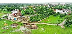 A view of Khajuri village | |
| Country | |
| State | Uttar Pradesh |
| District | Ghazipur |
| Established | 1630 |
| Founded by | Zamindar Hesam Khan |
| Government | |
| • Body | Gram panchayat |
| Area | |
| • Total | 291.56 ha (720.46 acres) |
| • Land | 286.493 ha (707.940 acres) |
| • Water | 5.067 ha (12.521 acres) |
| Population (2011) | |
| • Total | 3,771 |
| • Density | 1,300/km2 (3,300/sq mi) |
| Languages | |
| • Official | Hindi, Bhojpuri |
| Time zone | UTC+5:30 (IST) |
| ISO 3166 code | IN-UP |
| Vehicle registration | UP 61 |
| Website | up |
Khajuri Kamsar is a village in Dildarnagar Kamsar in the Indian state of Uttar Pradesh. Its situated on the bank of Karamsaha. As of 2011 census the main population of the village lived in an area of 44 acres with 531 households.[1]
Historical population
| Year | Pop. | ±% |
|---|---|---|
| 1861 | 1,043 | — |
| 1871 | 1,137 | +9.0% |
| 1881 | 1,240 | +9.1% |
| 1891 | 1,355 | +9.3% |
| 1901 | 1,480 | +9.2% |
| 1911 | 1,642 | +10.9% |
| 1921 | 1,800 | +9.6% |
| 1931 | 1,970 | +9.4% |
| 1941 | 2,160 | +9.6% |
| 1951 | 2,190 | +1.4% |
| 1961 | 2,257 | +3.1% |
| 1971 | 2,565 | +13.6% |
| 1981 | 2,789 | +8.7% |
| 1991 | 3,238 | +16.1% |
| 2001 | 3,512 | +8.5% |
| 2011 | 3,771 | +7.4% |
| Source:Census of India[2][3][4] | ||
References
- ↑ "Bhulekh".
- ↑ "Census of India". mospi.gov.in. Archived from the original on 13 August 2008. Retrieved 23 June 2008.
- ↑ "2011 census of India".
- ↑ "Historical Census of India". Archived from the original on 17 February 2013. Retrieved 5 November 2015.
This article is issued from Wikipedia. The text is licensed under Creative Commons - Attribution - Sharealike. Additional terms may apply for the media files.