Kolovraty | |
|---|---|
Municipal District of Prague | |
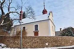
 Church of Saint Andrew | |
 Flag  Coat of arms | |
| Coordinates: 50°0′40″N 14°37′38″E / 50.01111°N 14.62722°E | |
| Country | Czech Republic |
| Region | Prague |
| District | Prague 22 |
| Time zone | UTC+1 (CET) |
| • Summer (DST) | UTC+2 (CEST) |
Kolovraty is a municipal district (městská část) in Prague, Czech Republic.[1][2]
References
- ↑ "Řeporyje". mistopisy. Retrieved 28 January 2019.
- ↑ "VODEST". Retrieved 28 January 2019.
This article is issued from Wikipedia. The text is licensed under Creative Commons - Attribution - Sharealike. Additional terms may apply for the media files.