Las Canteras | |
|---|---|
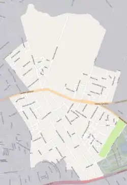 Street map of Las Canteras | |
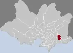 Location of Las Canteras in Montevideo | |
| Coordinates: 34°52′27″S 56°6′20″W / 34.87417°S 56.10556°W | |
| Country | |
| Department | Montevideo Department |
| City | Montevideo |
Las Canteras is a barrio (neighbourhood or district) of Montevideo, Uruguay.
Location
This barrio borders Malvín Norte to the west, Maroñas / Parque Guaraní to the northwest, Bañados de Carrasco to the north and northeast, Carrasco Norte to the east, Punta Gorda to the southeast and Malvín to the south.
Places of worship
- Church of Our Lady of Perpetual Help and St Eugene in the zone of La Cruz de Carrasco (Roman Catholic)
See also
This article is issued from Wikipedia. The text is licensed under Creative Commons - Attribution - Sharealike. Additional terms may apply for the media files.