Villa García–Manga Rural | |
|---|---|
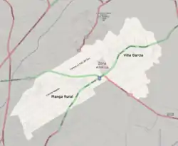
 Street map of Villa García–Manga Rural | |
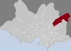
 Location of Villa García–Manga Rural in Montevideo | |
| Coordinates: 34°47′S 56°03′W / 34.783°S 56.050°W | |
| Country | |
| Department | Montevideo Department |
| City | Montevideo |
Villa García–Manga Rural is a barrio (neighbourhood or district) of Montevideo, Uruguay.
Formerly there was an important agricultural school here, established by Juan D. Jackson. Nowadays it has been transformed in the Jacksonville development.[1]
Places of worship
- Christ of Toledo Parish Church, Ruta 8 Nº 9303 (Roman Catholic)
- St. Joseph of Manga Chapel, in Jacksonville (Roman Catholic)
- Parish Church of St. Lawrence, Cno. Repetto 3937 (Roman Catholic, Salesian Sisters of Don Bosco)
See also
References
- ↑ History of Jacksonville Archived November 22, 2012, at the Wayback Machine (in Spanish)
External links
Wikimedia Commons has media related to Villa García, Montevideo.
- Official site of Villa García
- Revista Raíces/ Historia del barrio Manga
- Public school of Manga Rural on Camino Repetto 2952-3996
- "Cultural landscape of Villa Garcia" (PDF) (in Spanish). Facultad de Arquitectura - UdelaR. Retrieved 10 May 2013.
This article is issued from Wikipedia. The text is licensed under Creative Commons - Attribution - Sharealike. Additional terms may apply for the media files.
