Lee County | |
|---|---|
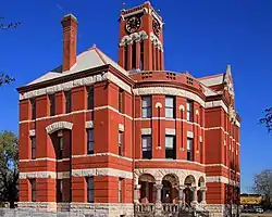
 County courthouse in Giddings, built 1899 | |
 Seal | |
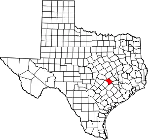
 Location within the U.S. state of Texas | |
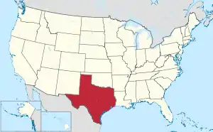
 Texas's location within the U.S. | |
| Coordinates: 30°19′N 96°58′W / 30.31°N 96.96°W | |
| Country | |
| State | |
| Founded | 1874 |
| Named for | Robert E. Lee |
| Seat | Giddings |
| Largest city | Giddings |
| Area | |
| • Total | 634 sq mi (1,640 km2) |
| • Land | 629 sq mi (1,630 km2) |
| • Water | 5.1 sq mi (13 km2) 0.8% |
| Population (2020) | |
| • Total | 17,478 |
| • Density | 28/sq mi (11/km2) |
| Time zone | UTC−6 (Central) |
| • Summer (DST) | UTC−5 (CDT) |
| Congressional district | 10th |
| Website | www |
Lee County is a county located in the U.S. state of Texas. As of the 2020 census, its population was 17,478.[1] Its county seat is Giddings.[2] The county was founded in 1874 and is named for Confederate General Robert E. Lee. The county has many Confederate memorials and monuments to the Confederate States of America.
Geography
According to the U.S. Census Bureau, the county has a total area of 634 square miles (1,640 km2), of which 5.1 square miles (13 km2) (0.8%) are covered by water.[3]
Major highways
Adjacent counties
- Milam County (north)
- Burleson County (northeast)
- Washington County (east)
- Fayette County (southeast)
- Bastrop County (southwest)
- Williamson County (northwest)
Demographics
| Census | Pop. | Note | %± |
|---|---|---|---|
| 1880 | 8,937 | — | |
| 1890 | 11,952 | 33.7% | |
| 1900 | 14,595 | 22.1% | |
| 1910 | 13,132 | −10.0% | |
| 1920 | 14,014 | 6.7% | |
| 1930 | 13,390 | −4.5% | |
| 1940 | 12,751 | −4.8% | |
| 1950 | 10,144 | −20.4% | |
| 1960 | 8,949 | −11.8% | |
| 1970 | 8,048 | −10.1% | |
| 1980 | 10,952 | 36.1% | |
| 1990 | 12,854 | 17.4% | |
| 2000 | 15,657 | 21.8% | |
| 2010 | 16,612 | 6.1% | |
| 2020 | 17,478 | 5.2% | |
| U.S. Decennial Census[4] 1850–2010[5] 2010[6] 2020[7] | |||
| Race / Ethnicity | Pop 2010[6] | Pop 2020[7] | % 2010 | % 2020 |
|---|---|---|---|---|
| White alone (NH) | 10,798 | 10,612 | 65.00% | 60.72% |
| Black or African American alone (NH) | 1,772 | 1,631 | 10.67% | 9.33% |
| Native American or Alaska Native alone (NH) | 44 | 47 | 0.26% | 0.27% |
| Asian alone (NH) | 52 | 57 | 0.31% | 0.33% |
| Pacific Islander alone (NH) | 17 | 1 | 0.10% | 0.01% |
| Some other race alone (NH) | 7 | 37 | 0.04% | 0.21% |
| Mixed/multiracial (NH) | 198 | 614 | 1.19% | 3.51% |
| Hispanic or Latino (any race) | 3,724 | 4,479 | 22.42% | 25.63% |
| Total | 16,612 | 17,478 | 100.00% | 100.00% |
Note: the US Census treats Hispanic/Latino as an ethnic category. This table excludes Latinos from the racial categories and assigns them to a separate category. Hispanics/Latinos can be of any race.
As of the census[8] of 2000, 15,657 people, 5,663 households, and 4,150 families were residing in the county. The population density was 25 inhabitants per square mile (9.7/km2). The 6,851 housing units had an average density of 11 units per square mile (4.2 units/km2). The racial makeup of the county was 76.59% White, 12.08% African American, 0.46% Native American, 0.24% Asian, 8.90% from other races, and 1.72% from two or more races. About 18.19% of the population were Hispanics or Latinos of any race. About 35.5% were of German and 8.3% American ancestry according to Census 2000; 80.1% spoke English, 14.4% Spanish, and 5.1% German as their first language. Of the 5,663 households, 35.7% had children under 18 living with them, 60.0% were married couples living together, 8.8% had a female householder with no husband present, and 26.7% were not families. About 23.8% of all households were made up of individuals, and 11.7% had someone living alone who was 65 or older. The average household size was 2.65, and the average family size was 3.15. In the county, the age distribution was 28.8% under 18, 9.2% from 18 to 24, 26.3% from 25 to 44, 21.4% from 45 to 64, and 14.4% who were 65 or older. The median age was 36 years. For every 100 females, there were 101.60 males. For every 100 females 18 and over, there were 98.0 males. The median income for a household in the county was $36,280, and for a family was $42,073. Males had a median income of $30,635 versus $21,611 for females. The per capita income for the county was $17,163. About 9.70% of families and 11.90% of the population were below the poverty line, including 13.70% of those under age 18 and 16.10% of those 65 or over. As of the 2010 census, Lee County has a similar ethnic makeup compared to the overall United States.[9]
Politics
Lee County was historically Democratic, although less so than the majority of Texas, as it was somewhat allied with the isolated Republican German-American Unionist stronghold centered in Gillespie and Kendall Counties. It nonetheless voted Democratic in every election up to 1976 except the landslide Republican triumphs of 1956 and 1972, plus the heavily war-influenced elections of 1916 and 1940, when its German-American population was suspicious of the Democratic Party's position towards Germany. Since 1980, like all of the rural white South, Lee County has become powerfully Republican. No Democratic presidential candidate has won a majority in the county since Jimmy Carter in 1976, although during the drought- and farm crisis-dominated 1988 election Michael Dukakis won a 14-vote plurality. In the past five elections, the GOP candidate has always passed two-thirds of the county's vote and Donald Trump exceeded three-quarters in 2016 & 2020.
| Year | Republican | Democratic | Third party | |||
|---|---|---|---|---|---|---|
| No. | % | No. | % | No. | % | |
| 2020 | 6,255 | 77.22% | 1,750 | 21.60% | 95 | 1.17% |
| 2016 | 4,997 | 76.20% | 1,372 | 20.92% | 189 | 2.88% |
| 2012 | 4,507 | 72.27% | 1,632 | 26.17% | 97 | 1.56% |
| 2008 | 4,312 | 67.62% | 2,000 | 31.36% | 65 | 1.02% |
| 2004 | 4,160 | 68.33% | 1,899 | 31.19% | 29 | 0.48% |
| 2000 | 3,699 | 66.82% | 1,733 | 31.30% | 104 | 1.88% |
| 1996 | 2,354 | 49.00% | 2,008 | 41.80% | 442 | 9.20% |
| 1992 | 2,108 | 41.68% | 1,847 | 36.52% | 1,103 | 21.81% |
| 1988 | 2,513 | 49.60% | 2,527 | 49.87% | 27 | 0.53% |
| 1984 | 2,967 | 64.05% | 1,659 | 35.82% | 6 | 0.13% |
| 1980 | 1,803 | 52.08% | 1,581 | 45.67% | 78 | 2.25% |
| 1976 | 1,348 | 40.81% | 1,937 | 58.64% | 18 | 0.54% |
| 1972 | 1,877 | 66.70% | 920 | 32.69% | 17 | 0.60% |
| 1968 | 1,075 | 35.97% | 1,283 | 42.92% | 631 | 21.11% |
| 1964 | 923 | 32.86% | 1,884 | 67.07% | 2 | 0.07% |
| 1960 | 1,048 | 42.76% | 1,369 | 55.85% | 34 | 1.39% |
| 1956 | 1,200 | 52.77% | 1,061 | 46.66% | 13 | 0.57% |
| 1952 | 1,316 | 48.61% | 1,389 | 51.31% | 2 | 0.07% |
| 1948 | 465 | 21.91% | 1,540 | 72.57% | 117 | 5.51% |
| 1944 | 771 | 35.11% | 953 | 43.40% | 472 | 21.49% |
| 1940 | 1,150 | 54.61% | 954 | 45.30% | 2 | 0.09% |
| 1936 | 271 | 18.99% | 1,155 | 80.94% | 1 | 0.07% |
| 1932 | 110 | 5.67% | 1,831 | 94.33% | 0 | 0.00% |
| 1928 | 449 | 27.63% | 1,176 | 72.37% | 0 | 0.00% |
| 1924 | 271 | 11.87% | 1,561 | 68.35% | 452 | 19.79% |
| 1920 | 325 | 14.65% | 712 | 32.09% | 1,182 | 53.27% |
| 1916 | 836 | 56.11% | 571 | 38.32% | 83 | 5.57% |
| 1912 | 134 | 13.58% | 687 | 69.60% | 166 | 16.82% |
Government and infrastructure

The Texas Youth Commission operates the Giddings State School in unincorporated Lee County, near Giddings.[11] As of 2004, the Giddings State School was Lee County's largest employer.[12]
Communities
City
- Giddings (county seat)
Town
Unincorporated communities
Education
School districts:[13]
- Dime Box Independent School District
- Elgin Independent School District
- Giddings Independent School District
- Lexington Independent School District
Most of Lee County is assigned to Blinn Junior College District. Austin Community College is the designated community college for portions of Lee County in Elgin ISD.[14]
See also
References
- ↑ "Lee County, Texas". United States Census Bureau. Retrieved January 30, 2022.
- ↑ "Find a County". National Association of Counties. Retrieved June 7, 2011.
- ↑ "2010 Census Gazetteer Files". United States Census Bureau. August 22, 2012. Retrieved May 3, 2015.
- ↑ "Decennial Census of Population and Housing by Decades". US Census Bureau.
- ↑ "Texas Almanac: Population History of Counties from 1850–2010" (PDF). Texas Almanac. Archived (PDF) from the original on October 9, 2022. Retrieved May 3, 2015.
- 1 2 "P2 Hispanic or Latino, and Not Hispanic or Latino by Race - 2010: DEC Redistricting Data (PL 94-171) - Lee County, Texas". United States Census Bureau.
- 1 2 "P2 Hispanic or Latino, and Not Hispanic or Latino by Race - 2020: DEC Redistricting Data (PL 94-171) - Lee County, Texas". United States Census Bureau.
- ↑ "U.S. Census website". United States Census Bureau. Retrieved May 14, 2011.
- ↑ Patterson, Thom (July 15, 2011). "Welcome to Little America: Lee County, Texas". CNN. Retrieved July 15, 2011.
- ↑ Leip, David. "Dave Leip's Atlas of U.S. Presidential Elections". uselectionatlas.org. Retrieved April 9, 2018.
- ↑ "Giddings State School". Texas Youth Commission. Archived from the original on February 20, 2011. Retrieved August 21, 2010.
- ↑ "Disruption at the Giddings State School". Texas Youth Commission. October 5, 2004. Archived from the original on July 22, 2011. Retrieved January 20, 2011.
- ↑ "2020 CENSUS - SCHOOL DISTRICT REFERENCE MAP: Lee County, TX" (PDF). U.S. Census Bureau. Archived (PDF) from the original on October 9, 2022. Retrieved June 29, 2022. - List
- ↑ Texas Education Code, Sec. 130.166. Austin Community College District Service Area. Sec. 130.168. Blinn Junior College District Service Area.
External links
- Lee County
- Lee County from the Handbook of Texas Online