Liangzhou
凉州区 | |
|---|---|
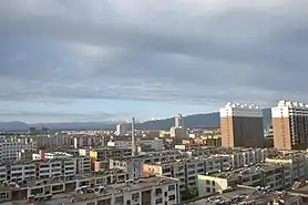
Clockwise from top: aerial view of the city, the Han Dynasty tombs where the Flying Horse of Gansu was found, Wuwei Railway station, part of the Luoshi Pagoda, and the Tiantishan Caves. | |
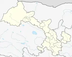
.png.webp) Liangzhou District (red) in Wuwei City (yellow) and Gansu | |
 Liangzhou Location in Gansu | |
| Coordinates: 37°55′42″N 102°38′31″E / 37.9283°N 102.642°E | |
| Country | China |
| Province | Gansu |
| Prefecture-level city | Wuwei |
| District seat | Dongdajie Subdistrict |
| Area | |
| • Total | 5,081 km2 (1,962 sq mi) |
| Population (2020)[1] | |
| • Total | 885,277 |
| • Density | 170/km2 (450/sq mi) |
| Time zone | UTC+8 (China Standard) |
| Postal code | 733000 |
| Website | www |
Liangzhou District (simplified Chinese: 凉州区; traditional Chinese: 涼州區; pinyin: Liángzhōu Qū) is a district and the seat of the city of Wuwei, Gansu province, China, bordering Inner Mongolia to the east.
Geography
Liangzhou District is located in the eastern part of the Hexi Corridor, north of the Qilian Mountains. It can be divided geographically into three main areas: the Qilian Mountains in the southwest, the Hexi Corridor in the center, and the Alashan Plateau semi-desert in the northeast.[2] Liangzhou District is an agricultural oasis located in the Shiyang River (石羊河) catchment area.[3][4]
Administrative divisions
Liangzhou District is divided to 9 subdistricts, 37 towns and 2 others.[5]
- Subdistricts
|
|
- Towns
|
|
|
- Others
- Jiuduntan Headquarters(九墩滩指挥部)
- Dengmaying Lake Ecological Construction Headquarters(邓马营湖生态建设指挥部)
See also
References
- ↑ "武威市第七次全国人口普查公报" (in Chinese). Government of Wuwei. 2021-05-27.
- ↑ http://www.xzqh.org/quhua/62gs/0602lz.htm
- ↑ "General | Groundwater Management Exploration Package". Archived from the original on July 24, 2011. Retrieved June 15, 2009.
- ↑ "Archived copy" (PDF). Archived from the original (PDF) on 2011-08-26. Retrieved 2011-05-24.
{{cite web}}: CS1 maint: archived copy as title (link) - ↑ "统计用区划代码 www.stats.gov.cn" (in Chinese). XZQH. Retrieved 2020-12-27.
This article is issued from Wikipedia. The text is licensed under Creative Commons - Attribution - Sharealike. Additional terms may apply for the media files.


.jpg.webp)