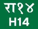
 | ||||
|---|---|---|---|---|
| महाकाली राजमार्ग | ||||
| Mahakali Highway | ||||
Mahakali Highway in red | ||||
| Route information | ||||
| Maintained by MoPIT (Department of Roads) | ||||
| Length | 325.15 km (202.04 mi) | |||
| Major junctions | ||||
| From | Api Municipality | |||
| To | Dhangadhi | |||
| Location | ||||
| Country | Nepal | |||
| Primary destinations | Patan Municipality, Amargadhi | |||
| Highway system | ||||
| ||||
Mahakali Highway (Nepali: महाकाली राजमार्ग) is a highway in western Nepal. It links Api Municipality in the Lesser Himalayas with the Western Terai region around Dhangadhi, spanning around 325 km and linking with State Highway 90 in India in the South. Mahakali Highway is proposed to be extended by 90 km to link Tinkar in Darchula District.[1][2]
References
- ↑ "::..DoR || Road Statistics ..::". Archived from the original on 2016-07-09.
- ↑ "Existing Highway and Proposed Extension". Department of Roads Nepal. Retrieved 1 June 2018.
This article is issued from Wikipedia. The text is licensed under Creative Commons - Attribution - Sharealike. Additional terms may apply for the media files.