20°42′36″N 103°9′0″W / 20.71000°N 103.15000°W
Matatlàn | |
|---|---|
Town | |
| Motto: Pueblo de Fé[1] | |
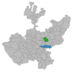
 Location of the municipality in Jalisco | |
 Matatlàn | |
| Coordinates: 20°42′36″N 103°9′0″W / 20.71000°N 103.15000°W | |
| Country | |
| State | Jalisco |
| Municipality | Zapotlanejo |
| Town | Matatlàn |
| Earliest Documented | 1537 |
| Population (2016) | |
| • Total | 2,000 |
| Time zone | UTC-6 (Central (US Central)) |
| • Summer (DST) | UTC-5 (Central (US Central)) |
| Postal code | 45435[2] |
Matatlàn is a town in the municipality of Zapotlanejo in the Mexican state of Jalisco.
According to the 2015 census, there were 2,000 inhabitants in the town.[3]
Toponymy
Matatlán is a hybrid word, half of unknown origin and half Nahuatl. In the earliest written record it is written as el peñole Nochislán y pueblo,[4] el Pueblo de Matatan[5] or Matastán.[6][7] According to local folk etymology it is composed of "mata" (from Nahuatl net) and "tlán" (from Nahuatl place): the place of net fishing from its location near the Rio Verde.
Climate
| Climate data for Matatlàn | |||||||||||||
|---|---|---|---|---|---|---|---|---|---|---|---|---|---|
| Month | Jan | Feb | Mar | Apr | May | Jun | Jul | Aug | Sep | Oct | Nov | Dec | Year |
| Mean daily maximum °C (°F) | 26 (79) |
28.0 (82.4) |
30.3 (86.5) |
33 (91) |
34.0 (93.2) |
31.3 (88.3) |
28.4 (83.1) |
28.2 (82.8) |
28 (82) |
27.7 (81.9) |
27.5 (81.5) |
26.2 (79.2) |
29.0 (84.2) |
| Mean daily minimum °C (°F) | 6.6 (43.9) |
7.6 (45.7) |
9.0 (48.2) |
11.3 (52.3) |
14 (57) |
16 (61) |
15.5 (59.9) |
15.3 (59.5) |
14.9 (58.8) |
12.3 (54.1) |
9 (48) |
7.3 (45.1) |
11.6 (52.9) |
| Average precipitation mm (inches) | 15 (0.6) |
5.1 (0.2) |
5.1 (0.2) |
5.1 (0.2) |
25 (1) |
170 (6.7) |
220 (8.8) |
220 (8.6) |
150 (5.8) |
43 (1.7) |
7.6 (0.3) |
5.1 (0.2) |
870 (34.4) |
| Source: Weatherbase [8] | |||||||||||||
History
The town of Matatlán was settled by pre-Hispanic inhabitants, the Tecuexes, who established themselves in the area about 1218. Nuño de Guzmán writes that there were more than 1,000 people (men, women and children) in the area upon his first exploration of the region on Friday 26 of February 1526.[9][10]
Spanish settlement in the area began around 1523 and the town has been inhabited since that time. The early agricultural products of the area were wheat and piloncillo made from cane sugar[11] around the ruins of the Hacienda de Colimilla which can be found five kilometers to the east of the town.
External links
References
- ↑ "Matatlan Pueblo De Fe - Zapotlanejo - Village | Facebook". www.facebook.com.
- ↑ "Código Postal Pueblo Matatlan, Jalisco". codigo-postal.co.
- ↑ "Gobierno Municipal de Zapotlanejo :: Estamos puestos". zapotlanejo.gob.mx.
- ↑ Gutiérrez Alvizo, José Manuel. Un pueblo de raíz Tecuexe: Historia de Zapotlanejo y Matatlán Tomo I. Guadalajara, Jalisco, Mexico. 2018. p.248. Fig. Mapa del año 1589
- ↑ Gutiérrez Alvizo, José Manuel. Un puelblo de raíz Tecuexe: Historia de Zapotlanejo y Matatlán Tomo I. Guadalajara, Jalisco, Mexico. 2018. p.131. Fig. Mapa del año 1780
- ↑ Lancaster-Jones, Ricardo. Haciendas de Jalisco y aledaños (1506-1821). Ed. Talleres Vera, Guadalajara. 1974. p.65.
- ↑ Gutiérrez Alvizo, José Manuel. Un puelblo de raíz Tecuexe: Historia de Zapotlanejo y Matatlán Tomo I. Guadalajara, Jalisco, Mexico. 2018. p.141.
- ↑ "Weatherbase: Historical Weather for Matatlàn, Jalisco". Weatherbase. 2011. Retrieved on November 24, 2011.
- ↑ De Guzmán, Nuño Beltran. Crónicas de la conquista del reino de la Nueva Galicia en el territorio de la Nueva España. Instituto Jaliscense de Anthropología de Guadalajara, IJAH e INAH, Guadalajara 1963. p29.
- ↑ Gutiérrez Alvizo, José Manuel. Un puelblo de raíz Tecuexe: Historia de Zapotlanejo y Matatlán Tomo I. Guadalajara, Jalisco, Mexico. 2018. p.108.
- ↑ Gutiérrez Alvizo, José Manuel. Un puelblo de raíz Tecuexe: Historia de Zapotlanejo y Matatlán Tomo I. Guadalajara, Jalisco, Mexico. 2018. p.175.
