Montredon-Labessonnié | |
|---|---|
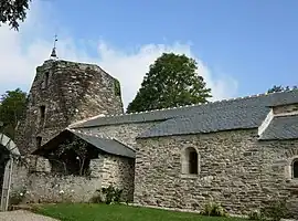 The church in Montredon-Labessonié | |
.svg.png.webp) Coat of arms | |
Location of Montredon-Labessonnié | |
 Montredon-Labessonnié 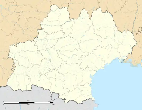 Montredon-Labessonnié | |
| Coordinates: 43°43′16″N 2°19′38″E / 43.7211°N 2.3272°E | |
| Country | France |
| Region | Occitania |
| Department | Tarn |
| Arrondissement | Castres |
| Canton | Le Haut Dadou |
| Government | |
| • Mayor (2020–2026) | Jean-Paul Chamayou[1] |
| Area 1 | 110.88 km2 (42.81 sq mi) |
| Population | 2,049 |
| • Density | 18/km2 (48/sq mi) |
| Time zone | UTC+01:00 (CET) |
| • Summer (DST) | UTC+02:00 (CEST) |
| INSEE/Postal code | 81182 /81360 |
| Elevation | 196–644 m (643–2,113 ft) (avg. 570 m or 1,870 ft) |
| 1 French Land Register data, which excludes lakes, ponds, glaciers > 1 km2 (0.386 sq mi or 247 acres) and river estuaries. | |
Montredon-Labessonnie (French pronunciation: [mɔ̃tʁədɔ̃ labɛsɔnje]; Occitan: La Bessoniá de Montredond) is a commune in the Tarn department in southern France.
The commune has several shops, a planetarium, a cinema, a tourist information centre, a hotel, cafe-bars among other venues.
Geography
The commune is traversed by the river Dadou.
Population
| Year | Pop. | ±% p.a. |
|---|---|---|
| 1968 | 2,327 | — |
| 1975 | 2,058 | −1.74% |
| 1982 | 2,167 | +0.74% |
| 1990 | 2,111 | −0.33% |
| 1999 | 2,030 | −0.43% |
| 2007 | 2,058 | +0.17% |
| 2012 | 2,084 | +0.25% |
| 2017 | 2,004 | −0.78% |
| Source: INSEE[3] | ||
See also
References
- ↑ "Répertoire national des élus: les maires". data.gouv.fr, Plateforme ouverte des données publiques françaises (in French). 2 December 2020.
- ↑ "Populations légales 2021". The National Institute of Statistics and Economic Studies. 28 December 2023.
- ↑ Population en historique depuis 1968, INSEE
Wikimedia Commons has media related to Montredon-Labessonnié.
This article is issued from Wikipedia. The text is licensed under Creative Commons - Attribution - Sharealike. Additional terms may apply for the media files.