Pietracamela | |
|---|---|
| Comune di Pietracamela | |
 | |
Location of Pietracamela | |
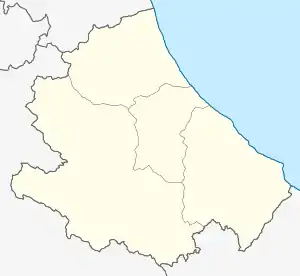
 Pietracamela Location of Pietracamela in Italy  Pietracamela Pietracamela (Abruzzo) | |
| Coordinates: 42°32′N 13°33′E / 42.533°N 13.550°E | |
| Country | Italy |
| Region | Abruzzo |
| Province | Teramo (TE) |
| Frazioni | Intermesoli, Prati di Tivo |
| Area | |
| • Total | 44 km2 (17 sq mi) |
| Elevation | 1,005 m (3,297 ft) |
| Population (Dec. 2004)[2] | |
| • Total | 312 |
| • Density | 7.1/km2 (18/sq mi) |
| Demonym | Pretaroli |
| Time zone | UTC+1 (CET) |
| • Summer (DST) | UTC+2 (CEST) |
| Postal code | 64047 |
| Dialing code | 0861 |
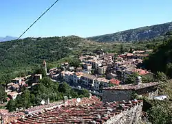
Pietracamela (locally La Pròtë) is a town and comune in Teramo province in the Abruzzo region of eastern Italy. It is located at the feet of the Gran Sasso massif, in the natural park known as the "Gran Sasso e Monti della Laga National Park". It is one of I Borghi più belli d'Italia ("The most beautiful villages of Italy").[3]
It is notable for the Pretarolo language an ultra-endangered language spoken by under 28 speakers.

Pietracamela at the feet of Gran Sasso.
References
- ↑ "Superficie di Comuni Province e Regioni italiane al 9 ottobre 2011". Italian National Institute of Statistics. Retrieved 16 March 2019.
- ↑ "Popolazione Residente al 1° Gennaio 2018". Italian National Institute of Statistics. Retrieved 16 March 2019.
- ↑ "Abruzzo" (in Italian). Retrieved 1 August 2023.
This article is issued from Wikipedia. The text is licensed under Creative Commons - Attribution - Sharealike. Additional terms may apply for the media files.
