Tortoreto | |
|---|---|
| Comune di Tortoreto | |
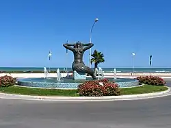
 La Sirena – Statue located at the south end of Tortoreto Lido | |
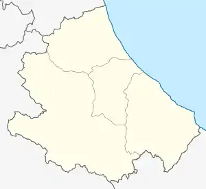
Location of Tortoreto | |
 Tortoreto Location of Tortoreto in Italy  Tortoreto Tortoreto (Abruzzo) | |
| Coordinates: 42°48′N 13°55′E / 42.800°N 13.917°E | |
| Country | Italy |
| Region | Abruzzo |
| Province | Teramo (TE) |
| Frazioni | Cavatassi, Colli, Salino, Terrabianca |
| Government | |
| • Mayor | Domenico Piccioni (Centre-right) |
| Area | |
| • Total | 22.97 km2 (8.87 sq mi) |
| Elevation | 239 m (784 ft) |
| Population (31 July 2023)[2] | |
| • Total | 11,756 |
| • Density | 510/km2 (1,300/sq mi) |
| Demonym | Tortoretani |
| Time zone | UTC+1 (CET) |
| • Summer (DST) | UTC+2 (CEST) |
| Postal code | 64018 |
| Dialing code | 0861 |
| Patron saint | San Nicola di Bari |
| Saint day | 6 December |
| Website | Official website |
Tortoreto Italian pronunciation: [tortoˈreto] (Teramano: Tërtërètë) is a coastal town and comune of the province of Teramo in the Abruzzo region of Italy.
It has two distinct parts. The old town is on a hill not far from the Adriatic Sea. The new part, usually referred to as Tortoreto Lido, is seaside and located next to SS 16.
Tortoreto can be reached by direct rail service or by flying to the Pescara airport and then travelling 45 kilometres (28 mi) north.
The comune of Alba Adriatica was created in 1956 by splitting it off from Tortoreto.
Toponymy
The name of the town is due to the large presence of turtle doves (tortore) during the Middle Ages.
Pope Gregory I noticed in a letter the large amount of these species of birds which used to live in this area. Later on, the town created on the top of the hills after the barbarian invasions started to be called Turturitus[3] or Turturetum,[4] and, eventually, the current denomination of Tortoreto came into common use.
Climate
| Climate data for Tortoreto. Temperature, precipitation, humidity and sun (last 30 years). | |||||||||||||
|---|---|---|---|---|---|---|---|---|---|---|---|---|---|
| Month | Jan | Feb | Mar | Apr | May | Jun | Jul | Aug | Sep | Oct | Nov | Dec | Year |
| Mean daily maximum °C (°F) | 11 (52) |
12 (54) |
14 (57) |
18 (64) |
22 (72) |
26 (79) |
29 (84) |
29 (84) |
25 (77) |
21 (70) |
16 (61) |
12 (54) |
20 (67) |
| Mean daily minimum °C (°F) | 2 (36) |
3 (37) |
4 (39) |
7 (45) |
11 (52) |
15 (59) |
17 (63) |
17 (63) |
14 (57) |
11 (52) |
6 (43) |
3 (37) |
9 (49) |
| Average precipitation mm (inches) | 55 (2.2) |
53 (2.1) |
63 (2.5) |
55 (2.2) |
35 (1.4) |
44 (1.7) |
34 (1.3) |
54 (2.1) |
61 (2.4) |
74 (2.9) |
71 (2.8) |
77 (3.0) |
676 (26.6) |
| Average relative humidity (%) | 74 | 73 | 72 | 71 | 72 | 70 | 69 | 71 | 72 | 75 | 76 | 76 | 73 |
| Mean daily sunshine hours | 3 | 4 | 5 | 6 | 8 | 9 | 10 | 9 | 7 | 6 | 4 | 3 | 6 |
| Source: http://www.ilmeteo.it/portale/medie-climatiche/Tortoreto?refresh_ce[5] | |||||||||||||
Education
In Tortoreto there are two state primary schools and two state middle schools,[6] which are overall attended by about 680 students,[7] as well as a number of state and private child care institutions and nursery schools.
There are also two private vocational secondary schools.
Economy
During the summer season, the main economic activity is tourism.
Its geographic position, climate, facilities and environmental projects, have all been planned or used to further tourism. Tortoreto has been awarded the European Blue Flag in 1992 and, then, from 1998 until 2023.
Fishing was a common activity in Tortoreto before tourism and it continues on a smaller scale to the present. Another common activity in the area was farming, which produced substantial amounts of olive oil and wheat. This activity continues today on a smaller scale too.
International relations
Tortoreto is twinned with:
.svg.png.webp) Habay, Belgium
Habay, Belgium
References
- ↑ "Superficie di Comuni Province e Regioni italiane al 9 ottobre 2011". Italian National Institute of Statistics. Retrieved 16 March 2019.
- ↑ ISTAT data.
- ↑ See Leo of Ostia, Chronicon monasterii Casinensis.
- ↑ Niccola Palma, Storia ecclesiastica e civile della regione più settentrionale del Regno di Napoli – detta dagli antichi Praetutium, ne' bassi tempi Aprutium – oggi città di Teramo e Diocesi Aprutina, volume I, Ubaldo Angeletti Stampatore dell'Intendenza, Teramo 1834, pp. 16–22.
- ↑ "Data from the Pescara Airport Meteorological Station". IlMeteo.it. Retrieved 12 June 2015.
- ↑ "Scuole di Tortoreto" (in Italian). Tuttitalia.it. 2015. Archived from the original on 19 September 2009. Retrieved 12 June 2015.
- ↑ "L'istituto e il territorio" (in Italian). Istituto Comprensivo di Tortoreto. 2015. Archived from the original on 14 June 2015. Retrieved 12 June 2015.
External links
- Official website (in Italian)
