Rurange-lès-Thionville | |
|---|---|
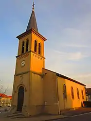 The church in Rurange-lès-Thionville | |
 Coat of arms | |
Location of Rurange-lès-Thionville | |
 Rurange-lès-Thionville 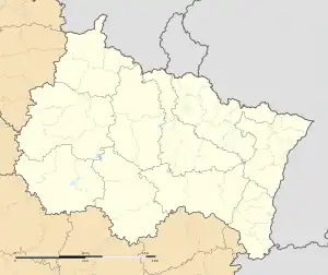 Rurange-lès-Thionville | |
| Coordinates: 49°16′40″N 6°14′01″E / 49.2778°N 6.2336°E | |
| Country | France |
| Region | Grand Est |
| Department | Moselle |
| Arrondissement | Thionville |
| Canton | Metzervisse |
| Intercommunality | CC de l'Arc Mosellan |
| Government | |
| • Mayor (2020–2026) | Pierre Rosaire[1] |
| Area 1 | 8.87 km2 (3.42 sq mi) |
| Population | 2,374 |
| • Density | 270/km2 (690/sq mi) |
| Time zone | UTC+01:00 (CET) |
| • Summer (DST) | UTC+02:00 (CEST) |
| INSEE/Postal code | 57602 /57310 |
| Elevation | 159–231 m (522–758 ft) (avg. 202 m or 663 ft) |
| 1 French Land Register data, which excludes lakes, ponds, glaciers > 1 km2 (0.386 sq mi or 247 acres) and river estuaries. | |
Rurange-lès-Thionville (French pronunciation: [ʁyʁɑ̃ʒ lɛ tjɔ̃vil], literally Rurange near Thionville; German: Rörchingen) is a commune in the Moselle department in Grand Est in north-eastern France.
Population
| Year | Pop. | ±% p.a. |
|---|---|---|
| 1968 | 553 | — |
| 1975 | 742 | +4.29% |
| 1982 | 1,044 | +5.00% |
| 1990 | 1,560 | +5.15% |
| 1999 | 1,630 | +0.49% |
| 2007 | 2,051 | +2.91% |
| 2012 | 2,368 | +2.92% |
| 2017 | 2,494 | +1.04% |
| Source: INSEE[3] | ||
See also
References
- ↑ "Répertoire national des élus: les maires" (in French). data.gouv.fr, Plateforme ouverte des données publiques françaises. 13 September 2022.
- ↑ "Populations légales 2021". The National Institute of Statistics and Economic Studies. 28 December 2023.
- ↑ Population en historique depuis 1968, INSEE
External links
 Media related to Rurange-lès-Thionville at Wikimedia Commons
This article is issued from Wikipedia. The text is licensed under Creative Commons - Attribution - Sharealike. Additional terms may apply for the media files.