Saint-Bonnet | |
|---|---|
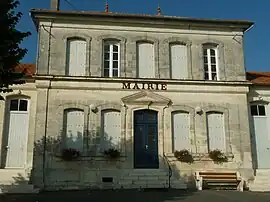 The town hall in Saint-Bonnet | |
Location of Saint-Bonnet | |
 Saint-Bonnet 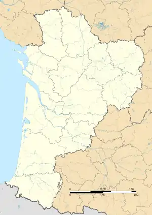 Saint-Bonnet | |
| Coordinates: 45°28′43″N 0°05′48″W / 45.4786°N 0.0967°W | |
| Country | France |
| Region | Nouvelle-Aquitaine |
| Department | Charente |
| Arrondissement | Cognac |
| Canton | Charente-Sud |
| Intercommunality | 4B Sud-Charente |
| Government | |
| • Mayor (2020–2026) | Sandrine Pourtau[1] |
| Area 1 | 17.77 km2 (6.86 sq mi) |
| Population | 410 |
| • Density | 23/km2 (60/sq mi) |
| Time zone | UTC+01:00 (CET) |
| • Summer (DST) | UTC+02:00 (CEST) |
| INSEE/Postal code | 16303 /16300 |
| Elevation | 45–109 m (148–358 ft) (avg. 80 m or 260 ft) |
| 1 French Land Register data, which excludes lakes, ponds, glaciers > 1 km2 (0.386 sq mi or 247 acres) and river estuaries. | |
Saint-Bonnet (French pronunciation: [sɛ̃ bɔnɛ]) is a commune in the Charente department in southwestern France.
Population
| Year | Pop. | ±% p.a. |
|---|---|---|
| 1968 | 470 | — |
| 1975 | 415 | −1.76% |
| 1982 | 369 | −1.66% |
| 1990 | 374 | +0.17% |
| 1999 | 337 | −1.15% |
| 2009 | 376 | +1.10% |
| 2014 | 386 | +0.53% |
| 2020 | 406 | +0.85% |
| Source: INSEE[3] | ||
See also
References
- ↑ "Répertoire national des élus: les maires" (in French). data.gouv.fr, Plateforme ouverte des données publiques françaises. 13 September 2022.
- ↑ "Populations légales 2021". The National Institute of Statistics and Economic Studies. 28 December 2023.
- ↑ Population en historique depuis 1968, INSEE
Wikimedia Commons has media related to Saint-Bonnet (Charente).
This article is issued from Wikipedia. The text is licensed under Creative Commons - Attribution - Sharealike. Additional terms may apply for the media files.